You are here: Home > Network List > IU - Global Seismograph Network (GSN - IRIS/USGS) Stations List
> Station JOHN Johnston Island, USA > Earthquake Result Viewer
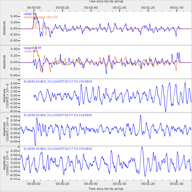
JOHN Johnston Island, USA - Earthquake Result Viewer
*The percent match for this event was below the threshold and hence no stack was calculated.
| Earthquake location: |
Tonga Islands |
| Earthquake latitude/longitude: |
-15.3/-173.6 |
| Earthquake time(UTC): |
2011/09/05 (248) 09:52:01 GMT |
| Earthquake Depth: |
37 km |
| Earthquake Magnitude: |
6.2 MB, 6.2 MS, 6.3 MW, 6.2 MW |
| Earthquake Catalog/Contributor: |
WHDF/NEIC |
|
| Network: |
IU Global Seismograph Network (GSN - IRIS/USGS) |
| Station: |
JOHN Johnston Island, USA |
| Lat/Lon: |
16.73 N/169.53 W |
| Elevation: |
2.0 m |
|
| Distance: |
32.1 deg |
| Az: |
7.397 deg |
| Baz: |
187.45 deg |
| Ray Param: |
$rayparam |
*The percent match for this event was below the threshold and hence was not used in the summary stack. |
|
| Radial Match: |
55.040985 % |
| Radial Bump: |
400 |
| Transverse Match: |
50.495564 % |
| Transverse Bump: |
329 |
| SOD ConfigId: |
558545 |
| Insert Time: |
2013-09-19 02:29:07.548 +0000 |
| GWidth: |
2.5 |
| Max Bumps: |
400 |
| Tol: |
0.001 |
|
Signal To Noise
| Channel | StoN | STA | LTA |
| IU:JOHN:00:BHZ:20110905T09:57:54.343989Z | 2.799995 | 4.945436E-6 | 1.7662303E-6 |
| IU:JOHN:00:BH1:20110905T09:57:54.343989Z | 1.2752409 | 2.8037732E-6 | 2.1986225E-6 |
| IU:JOHN:00:BH2:20110905T09:57:54.343989Z | 2.0413563 | 2.9125756E-6 | 1.4267846E-6 |
| Arrivals |
| Ps | |
| PpPs | |
| PsPs/PpSs | |


