You are here: Home > Network List > US - United States National Seismic Network Stations List
> Station HDIL Hopedale, Illinois, USA > Earthquake Result Viewer
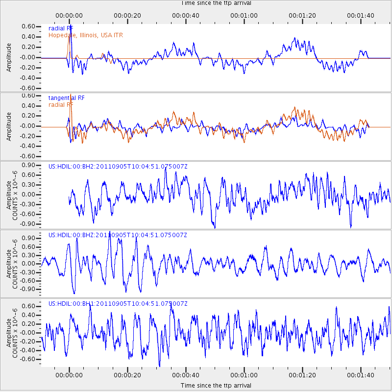
HDIL Hopedale, Illinois, USA - Earthquake Result Viewer
*The percent match for this event was below the threshold and hence no stack was calculated.
| Earthquake location: |
Tonga Islands |
| Earthquake latitude/longitude: |
-15.3/-173.6 |
| Earthquake time(UTC): |
2011/09/05 (248) 09:52:01 GMT |
| Earthquake Depth: |
37 km |
| Earthquake Magnitude: |
6.2 MB, 6.2 MS, 6.3 MW, 6.2 MW |
| Earthquake Catalog/Contributor: |
WHDF/NEIC |
|
| Network: |
US United States National Seismic Network |
| Station: |
HDIL Hopedale, Illinois, USA |
| Lat/Lon: |
40.56 N/89.29 W |
| Elevation: |
219 m |
|
| Distance: |
95.6 deg |
| Az: |
49.622 deg |
| Baz: |
254.766 deg |
| Ray Param: |
$rayparam |
*The percent match for this event was below the threshold and hence was not used in the summary stack. |
|
| Radial Match: |
60.229168 % |
| Radial Bump: |
400 |
| Transverse Match: |
65.23225 % |
| Transverse Bump: |
400 |
| SOD ConfigId: |
558545 |
| Insert Time: |
2013-09-19 02:30:14.461 +0000 |
| GWidth: |
2.5 |
| Max Bumps: |
400 |
| Tol: |
0.001 |
|
Signal To Noise
| Channel | StoN | STA | LTA |
| US:HDIL:00:BHZ:20110905T10:04:51.075007Z | 2.0502586 | 5.7183E-7 | 2.7890627E-7 |
| US:HDIL:00:BH1:20110905T10:04:51.075007Z | 1.045982 | 2.7059744E-7 | 2.587018E-7 |
| US:HDIL:00:BH2:20110905T10:04:51.075007Z | 1.2287605 | 3.7329085E-7 | 3.0379465E-7 |
| Arrivals |
| Ps | |
| PpPs | |
| PsPs/PpSs | |


