You are here: Home > Network List > CN - Canadian National Seismograph Network Stations List
> Station INK INUVIK, NT, CANADA.ANADA > Earthquake Result Viewer
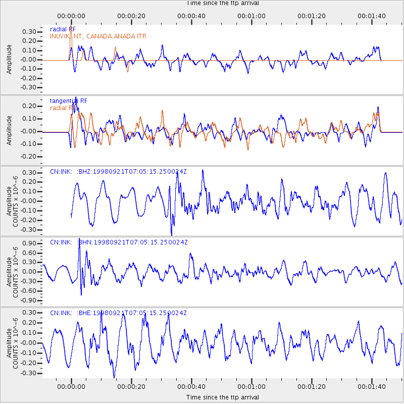
INK INUVIK, NT, CANADA.ANADA - Earthquake Result Viewer
*The percent match for this event was below the threshold and hence no stack was calculated.
| Earthquake location: |
Minahassa Peninsula, Sulawesi |
| Earthquake latitude/longitude: |
0.3/122.5 |
| Earthquake time(UTC): |
1998/09/21 (264) 06:52:41 GMT |
| Earthquake Depth: |
147 km |
| Earthquake Magnitude: |
6.1 MB, 6.0 UNKNOWN, 5.9 MW |
| Earthquake Catalog/Contributor: |
WHDF/NEIC |
|
| Network: |
CN Canadian National Seismograph Network |
| Station: |
INK INUVIK, NT, CANADA.ANADA |
| Lat/Lon: |
68.31 N/133.52 W |
| Elevation: |
40 m |
|
| Distance: |
94.9 deg |
| Az: |
21.227 deg |
| Baz: |
283.139 deg |
| Ray Param: |
$rayparam |
*The percent match for this event was below the threshold and hence was not used in the summary stack. |
|
| Radial Match: |
60.525837 % |
| Radial Bump: |
400 |
| Transverse Match: |
77.89717 % |
| Transverse Bump: |
400 |
| SOD ConfigId: |
4480 |
| Insert Time: |
2010-02-27 06:23:24.888 +0000 |
| GWidth: |
2.5 |
| Max Bumps: |
400 |
| Tol: |
0.001 |
|
Signal To Noise
| Channel | StoN | STA | LTA |
| CN:INK: :BHN:19980921T07:05:15.250024Z | 1.7309943 | 3.7617394E-7 | 2.173167E-7 |
| CN:INK: :BHE:19980921T07:05:15.250024Z | 1.3265918 | 1.425454E-7 | 1.0745234E-7 |
| CN:INK: :BHZ:19980921T07:05:15.250024Z | 1.1504116 | 1.4923125E-7 | 1.2971988E-7 |
| Arrivals |
| Ps | |
| PpPs | |
| PsPs/PpSs | |


