You are here: Home > Network List > US - United States National Seismic Network Stations List
> Station OGNE Ogallala, Nebraska, USA > Earthquake Result Viewer
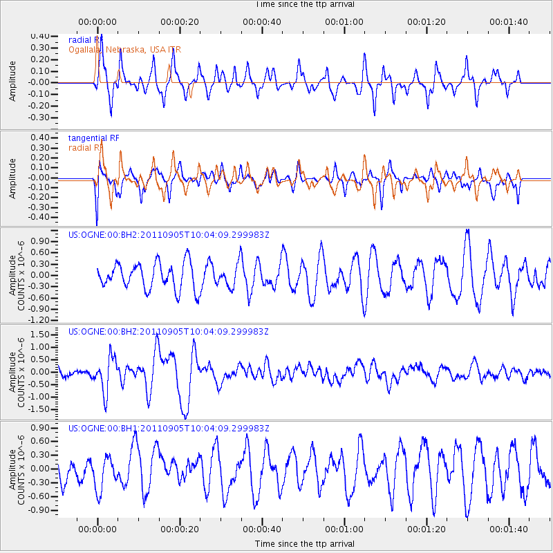
OGNE Ogallala, Nebraska, USA - Earthquake Result Viewer
*The percent match for this event was below the threshold and hence no stack was calculated.
| Earthquake location: |
Tonga Islands |
| Earthquake latitude/longitude: |
-15.3/-173.6 |
| Earthquake time(UTC): |
2011/09/05 (248) 09:52:01 GMT |
| Earthquake Depth: |
37 km |
| Earthquake Magnitude: |
6.2 MB, 6.2 MS, 6.3 MW, 6.2 MW |
| Earthquake Catalog/Contributor: |
WHDF/NEIC |
|
| Network: |
US United States National Seismic Network |
| Station: |
OGNE Ogallala, Nebraska, USA |
| Lat/Lon: |
40.95 N/102.03 W |
| Elevation: |
0.0 m |
|
| Distance: |
86.6 deg |
| Az: |
46.056 deg |
| Baz: |
246.53 deg |
| Ray Param: |
$rayparam |
*The percent match for this event was below the threshold and hence was not used in the summary stack. |
|
| Radial Match: |
73.01519 % |
| Radial Bump: |
381 |
| Transverse Match: |
59.80521 % |
| Transverse Bump: |
400 |
| SOD ConfigId: |
558545 |
| Insert Time: |
2013-09-19 02:30:56.228 +0000 |
| GWidth: |
2.5 |
| Max Bumps: |
400 |
| Tol: |
0.001 |
|
Signal To Noise
| Channel | StoN | STA | LTA |
| US:OGNE:00:BHZ:20110905T10:04:09.299983Z | 4.490856 | 7.163764E-7 | 1.595189E-7 |
| US:OGNE:00:BH1:20110905T10:04:09.299983Z | 1.4480847 | 3.66793E-7 | 2.5329527E-7 |
| US:OGNE:00:BH2:20110905T10:04:09.299983Z | 0.90446395 | 3.1168736E-7 | 3.4461004E-7 |
| Arrivals |
| Ps | |
| PpPs | |
| PsPs/PpSs | |


