You are here: Home > Network List > CN - Canadian National Seismograph Network Stations List
> Station INK INUVIK, NT, CANADA.ANADA > Earthquake Result Viewer
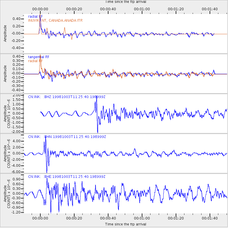
INK INUVIK, NT, CANADA.ANADA - Earthquake Result Viewer
*The percent match for this event was below the threshold and hence no stack was calculated.
| Earthquake location: |
Northwest Of Ryukyu Islands |
| Earthquake latitude/longitude: |
28.5/127.6 |
| Earthquake time(UTC): |
1998/10/03 (276) 11:15:42 GMT |
| Earthquake Depth: |
227 km |
| Earthquake Magnitude: |
5.6 MB, 6.1 UNKNOWN, 6.1 MW |
| Earthquake Catalog/Contributor: |
WHDF/NEIC |
|
| Network: |
CN Canadian National Seismograph Network |
| Station: |
INK INUVIK, NT, CANADA.ANADA |
| Lat/Lon: |
68.31 N/133.52 W |
| Elevation: |
40 m |
|
| Distance: |
67.0 deg |
| Az: |
23.515 deg |
| Baz: |
289.176 deg |
| Ray Param: |
$rayparam |
*The percent match for this event was below the threshold and hence was not used in the summary stack. |
|
| Radial Match: |
67.647934 % |
| Radial Bump: |
400 |
| Transverse Match: |
70.77034 % |
| Transverse Bump: |
400 |
| SOD ConfigId: |
4480 |
| Insert Time: |
2010-02-27 06:23:35.734 +0000 |
| GWidth: |
2.5 |
| Max Bumps: |
400 |
| Tol: |
0.001 |
|
Signal To Noise
| Channel | StoN | STA | LTA |
| CN:INK: :BHN:19981003T11:25:40.198999Z | 9.389686 | 2.3119287E-6 | 2.4622003E-7 |
| CN:INK: :BHE:19981003T11:25:40.198999Z | 2.3160129 | 4.1989475E-7 | 1.8130069E-7 |
| CN:INK: :BHZ:19981003T11:25:40.198999Z | 4.56985 | 7.9024124E-7 | 1.72925E-7 |
| Arrivals |
| Ps | |
| PpPs | |
| PsPs/PpSs | |


