
BLA Blacksburg, Virginia, USA - Earthquake Result Viewer
| ||||||||||||||||||
| ||||||||||||||||||
| ||||||||||||||||||
|
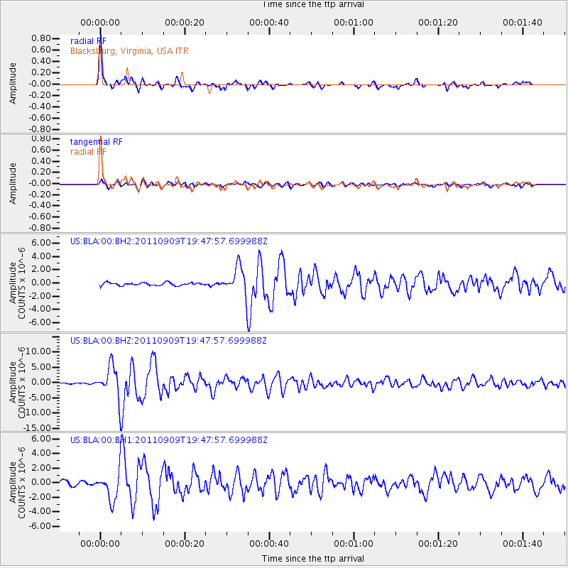
Signal To Noise
| Channel | StoN | STA | LTA |
| US:BLA:00:BHZ:20110909T19:47:57.699988Z | 19.152086 | 5.440984E-6 | 2.8409352E-7 |
| US:BLA:00:BH1:20110909T19:47:57.699988Z | 6.5411305 | 2.0620298E-6 | 3.1524056E-7 |
| US:BLA:00:BH2:20110909T19:47:57.699988Z | 10.564445 | 2.1914998E-6 | 2.0744108E-7 |
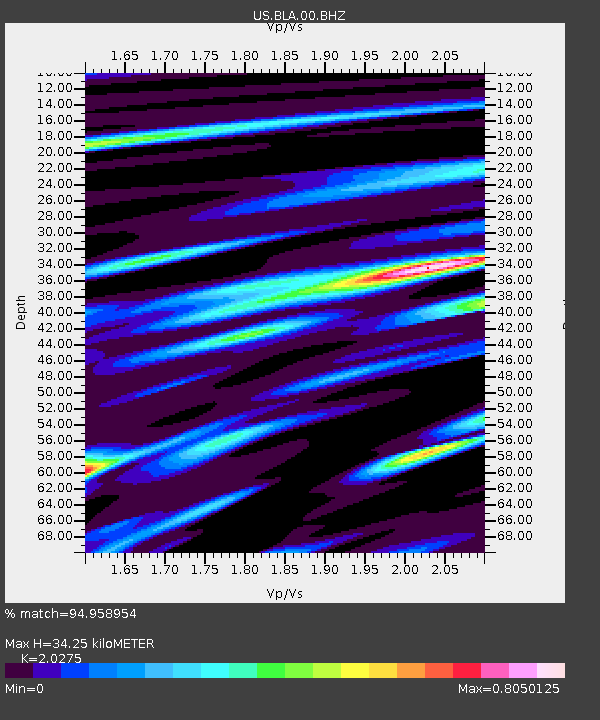
| Arrivals | |
| Ps | 6.1 SECOND |
| PpPs | 16 SECOND |
| PsPs/PpSs | 22 SECOND |

