LRAL Lakeview Retreat, Alabama, USA - Earthquake Result Viewer
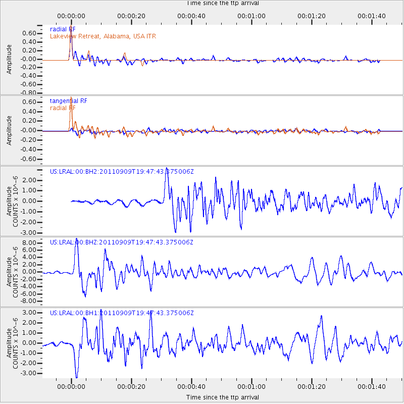
Earthquake location: Vancouver Island, Canada Region
Earthquake latitude/longitude: 49.5/-126.9
Earthquake time(UTC): 2011/09/09 (252) 19:41:34 GMT
Earthquake Depth: 22 km
Earthquake Magnitude: 6.3 MB, 6.4 MS, 6.4 MW, 6.5 MW
Earthquake Catalog/Contributor: WHDF/NEIC
Network: US United States National Seismic Network
Station: LRAL Lakeview Retreat, Alabama, USA
Lat/Lon: 33.03 N/87.00 W
Elevation: 130 m
Distance: 33.7 deg
Az: 104.11 deg
Baz: 311.219 deg
Ray Param: 0.07803914
Estimated Moho Depth: 20.25 km
Estimated Crust Vp/Vs: 2.10
Assumed Crust Vp: 6.565 km/s
Estimated Crust Vs: 3.13 km/s
Estimated Crust Poisson's Ratio: 0.35
Radial Match: 91.81115 %
Radial Bump: 400
Transverse Match: 75.465004 %
Transverse Bump: 400
SOD ConfigId: 558545
Insert Time: 2013-09-19 02:39:39.506 +0000
GWidth: 2.5
Max Bumps: 400
Tol: 0.001

Signal To Noise

ChannelStoNSTALTA
US:LRAL:00:BHZ:20110909T19:47:43.375006Z23.8296724.5485376E-61.9087705E-7
US:LRAL:00:BH1:20110909T19:47:43.375006Z10.6479171.7383769E-61.6325981E-7
US:LRAL:00:BH2:20110909T19:47:43.375006Z9.3919721.6492863E-61.7560596E-7
Arrivals
Ps3.6 SECOND
PpPs8.9 SECOND
PsPs/PpSs13 SECOND