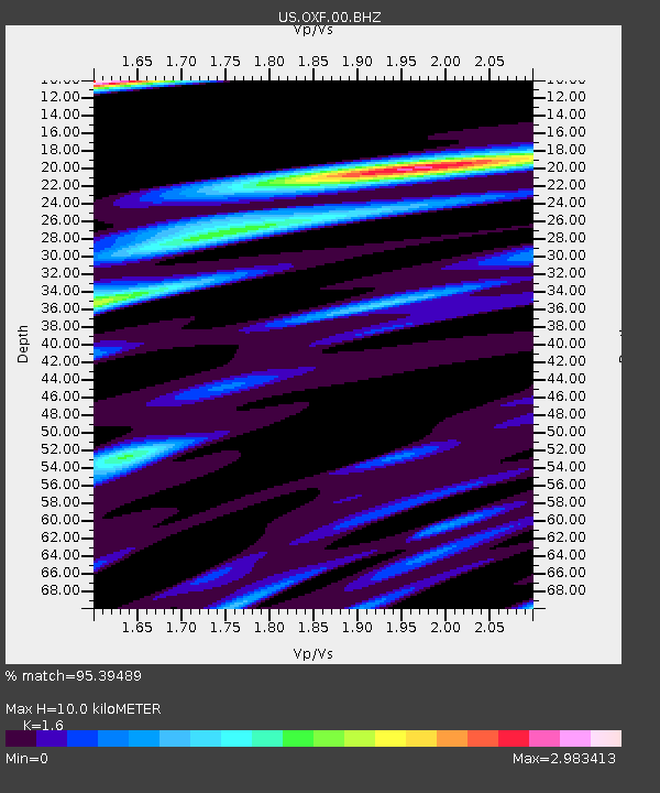
OXF Oxford, Mississippi, USA - Earthquake Result Viewer

Earthquake location: Vancouver Island, Canada Region
Earthquake latitude/longitude: 49.5/-126.9
Earthquake time(UTC): 2011/09/09 (252) 19:41:34 GMT
Earthquake Depth: 22 km
Earthquake Magnitude: 6.3 MB, 6.4 MS, 6.4 MW, 6.5 MW
Earthquake Catalog/Contributor: WHDF/NEIC
Network: US United States National Seismic Network
Station: OXF Oxford, Mississippi, USA
Lat/Lon: 34.51 N/89.41 W
Elevation: 101 m
Distance: 31.3 deg
Az: 104.47 deg
Baz: 310.188 deg
Ray Param: 0.079099976
Estimated Moho Depth: 10.0 km
Estimated Crust Vp/Vs: 1.60
Assumed Crust Vp: 6.38 km/s
Estimated Crust Vs: 3.988 km/s
Estimated Crust Poisson's Ratio: 0.18
Radial Match: 95.39489 %
Radial Bump: 400
Transverse Match: 80.58518 %
Transverse Bump: 400
SOD ConfigId: 558545
Insert Time: 2013-09-19 02:39:46.157 +0000
GWidth: 2.5
Max Bumps: 400
Tol: 0.001

Signal To Noise

ChannelStoNSTALTA
US:OXF:00:BHZ:20110909T19:47:21.699988Z64.9271559.106269E-61.4025363E-7
US:OXF:00:BH1:20110909T19:47:21.699988Z11.1464224.377014E-63.9268335E-7
US:OXF:00:BH2:20110909T19:47:21.699988Z10.5229525.421963E-65.1525114E-7
Arrivals
Ps1.0 SECOND
PpPs3.7 SECOND
PsPs/PpSs4.8 SECOND