TZTN Tazewell, Tennessee, USA - Earthquake Result Viewer
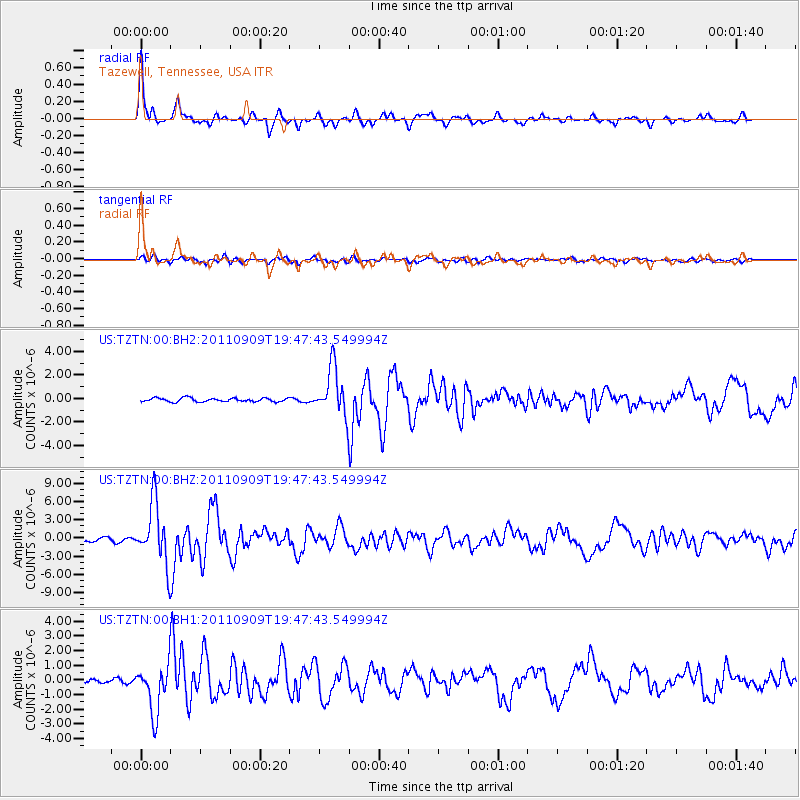
Earthquake location: Vancouver Island, Canada Region
Earthquake latitude/longitude: 49.5/-126.9
Earthquake time(UTC): 2011/09/09 (252) 19:41:34 GMT
Earthquake Depth: 22 km
Earthquake Magnitude: 6.3 MB, 6.4 MS, 6.4 MW, 6.5 MW
Earthquake Catalog/Contributor: WHDF/NEIC
Network: US United States National Seismic Network
Station: TZTN Tazewell, Tennessee, USA
Lat/Lon: 36.54 N/83.55 W
Elevation: 394 m
Distance: 33.8 deg
Az: 95.996 deg
Baz: 306.43 deg
Ray Param: 0.07803101
Estimated Moho Depth: 47.0 km
Estimated Crust Vp/Vs: 1.79
Assumed Crust Vp: 6.476 km/s
Estimated Crust Vs: 3.618 km/s
Estimated Crust Poisson's Ratio: 0.27
Radial Match: 92.50448 %
Radial Bump: 396
Transverse Match: 79.13434 %
Transverse Bump: 400
SOD ConfigId: 558545
Insert Time: 2013-09-19 02:39:51.253 +0000
GWidth: 2.5
Max Bumps: 400
Tol: 0.001

Signal To Noise

ChannelStoNSTALTA
US:TZTN:00:BHZ:20110909T19:47:43.549994Z16.9580944.9934356E-62.9445738E-7
US:TZTN:00:BH1:20110909T19:47:43.549994Z8.6269041.6392962E-61.9002138E-7
US:TZTN:00:BH2:20110909T19:47:43.549994Z12.9916752.0209286E-61.5555565E-7
Arrivals
Ps6.2 SECOND
PpPs19 SECOND
PsPs/PpSs25 SECOND