You are here: Home > Network List > CN - Canadian National Seismograph Network Stations List
> Station INK INUVIK, NT, CANADA.ANADA > Earthquake Result Viewer
INK INUVIK, NT, CANADA.ANADA - Earthquake Result Viewer
*The percent match for this event was below the threshold and hence no stack was calculated.
| Earthquake location: |
Northern Molucca Sea |
| Earthquake latitude/longitude: |
0.8/126.0 |
| Earthquake time(UTC): |
1998/10/28 (301) 16:25:03 GMT |
| Earthquake Depth: |
33 km |
| Earthquake Magnitude: |
6.2 MB, 6.2 MS, 6.6 UNKNOWN, 6.6 MW |
| Earthquake Catalog/Contributor: |
WHDF/NEIC |
|
| Network: |
CN Canadian National Seismograph Network |
| Station: |
INK INUVIK, NT, CANADA.ANADA |
| Lat/Lon: |
68.31 N/133.52 W |
| Elevation: |
40 m |
|
| Distance: |
93.1 deg |
| Az: |
21.474 deg |
| Baz: |
280.081 deg |
| Ray Param: |
$rayparam |
*The percent match for this event was below the threshold and hence was not used in the summary stack. |
|
| Radial Match: |
60.157547 % |
| Radial Bump: |
368 |
| Transverse Match: |
62.336407 % |
| Transverse Bump: |
400 |
| SOD ConfigId: |
4480 |
| Insert Time: |
2010-02-27 06:24:04.939 +0000 |
| GWidth: |
2.5 |
| Max Bumps: |
400 |
| Tol: |
0.001 |
|
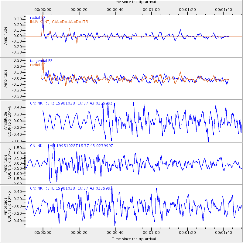
Signal To Noise
| Channel | StoN | STA | LTA |
| CN:INK: :BHN:19981028T16:37:43.023999Z | 4.508471 | 9.0658625E-7 | 2.0108507E-7 |
| CN:INK: :BHE:19981028T16:37:43.023999Z | 0.9750193 | 1.18456306E-7 | 1.2149124E-7 |
| CN:INK: :BHZ:19981028T16:37:43.023999Z | 1.6240854 | 2.4693878E-7 | 1.5204792E-7 |
| Arrivals |
| Ps | |
| PpPs | |
| PsPs/PpSs | |


