You are here: Home > Network List > CN - Canadian National Seismograph Network Stations List
> Station INK INUVIK, NT, CANADA.ANADA > Earthquake Result Viewer
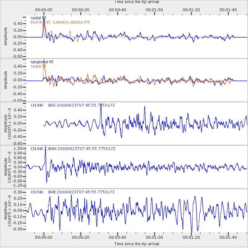
INK INUVIK, NT, CANADA.ANADA - Earthquake Result Viewer
*The percent match for this event was below the threshold and hence no stack was calculated.
| Earthquake location: |
Near East Coast Of Honshu, Japan |
| Earthquake latitude/longitude: |
38.8/142.4 |
| Earthquake time(UTC): |
2009/06/23 (174) 07:37:17 GMT |
| Earthquake Depth: |
37 km |
| Earthquake Magnitude: |
5.7 MB, 5.0 MS, 5.6 MW, 5.6 MW |
| Earthquake Catalog/Contributor: |
WHDF/NEIC |
|
| Network: |
CN Canadian National Seismograph Network |
| Station: |
INK INUVIK, NT, CANADA.ANADA |
| Lat/Lon: |
68.31 N/133.52 W |
| Elevation: |
40 m |
|
| Distance: |
52.4 deg |
| Az: |
27.815 deg |
| Baz: |
281.473 deg |
| Ray Param: |
$rayparam |
*The percent match for this event was below the threshold and hence was not used in the summary stack. |
|
| Radial Match: |
69.00356 % |
| Radial Bump: |
400 |
| Transverse Match: |
57.886425 % |
| Transverse Bump: |
400 |
| SOD ConfigId: |
2648 |
| Insert Time: |
2010-02-27 06:24:20.172 +0000 |
| GWidth: |
2.5 |
| Max Bumps: |
400 |
| Tol: |
0.001 |
|
Signal To Noise
| Channel | StoN | STA | LTA |
| CN:INK: :BHN:20090623T07:45:55.775017Z | 8.506768 | 4.995451E-7 | 5.872325E-8 |
| CN:INK: :BHE:20090623T07:45:55.775017Z | 1.4931626 | 1.06434335E-7 | 7.1281136E-8 |
| CN:INK: :BHZ:20090623T07:45:55.775017Z | 3.8256755 | 2.2271107E-7 | 5.8214834E-8 |
| Arrivals |
| Ps | |
| PpPs | |
| PsPs/PpSs | |


