You are here: Home > Network List > US - United States National Seismic Network Stations List
> Station EGMT Eagleton, Montana, USA > Earthquake Result Viewer
EGMT Eagleton, Montana, USA - Earthquake Result Viewer
*The percent match for this event was below the threshold and hence no stack was calculated.
| Earthquake location: |
Near Islands, Aleutian Islands |
| Earthquake latitude/longitude: |
53.1/173.0 |
| Earthquake time(UTC): |
2011/09/14 (257) 18:10:09 GMT |
| Earthquake Depth: |
15 km |
| Earthquake Magnitude: |
6.1 MB, 5.7 MS, 6.0 MW, 6.0 MW |
| Earthquake Catalog/Contributor: |
WHDF/NEIC |
|
| Network: |
US United States National Seismic Network |
| Station: |
EGMT Eagleton, Montana, USA |
| Lat/Lon: |
48.02 N/109.75 W |
| Elevation: |
1055 m |
|
| Distance: |
47.1 deg |
| Az: |
63.339 deg |
| Baz: |
306.619 deg |
| Ray Param: |
$rayparam |
*The percent match for this event was below the threshold and hence was not used in the summary stack. |
|
| Radial Match: |
75.91586 % |
| Radial Bump: |
400 |
| Transverse Match: |
60.935486 % |
| Transverse Bump: |
400 |
| SOD ConfigId: |
558545 |
| Insert Time: |
2013-09-19 02:51:28.399 +0000 |
| GWidth: |
2.5 |
| Max Bumps: |
400 |
| Tol: |
0.001 |
|
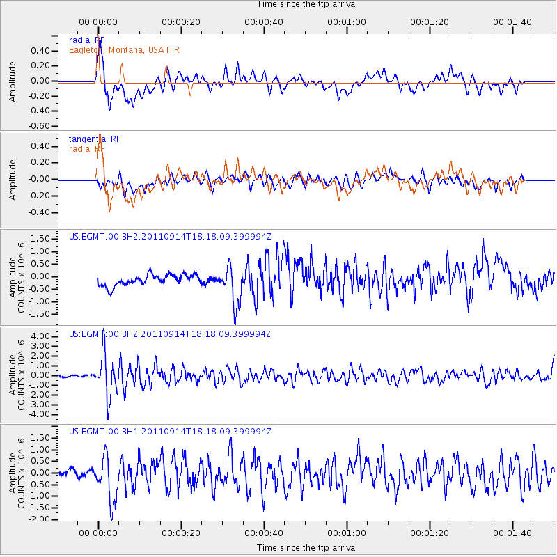
Signal To Noise
| Channel | StoN | STA | LTA |
| US:EGMT:00:BHZ:20110914T18:18:09.399994Z | 19.846035 | 2.1684723E-6 | 1.0926476E-7 |
| US:EGMT:00:BH1:20110914T18:18:09.399994Z | 4.730243 | 9.708621E-7 | 2.052457E-7 |
| US:EGMT:00:BH2:20110914T18:18:09.399994Z | 3.5622983 | 7.6167396E-7 | 2.1381533E-7 |
| Arrivals |
| Ps | |
| PpPs | |
| PsPs/PpSs | |


