You are here: Home > Network List > IU - Global Seismograph Network (GSN - IRIS/USGS) Stations List
> Station HNR Honiara, Solomon Islands > Earthquake Result Viewer
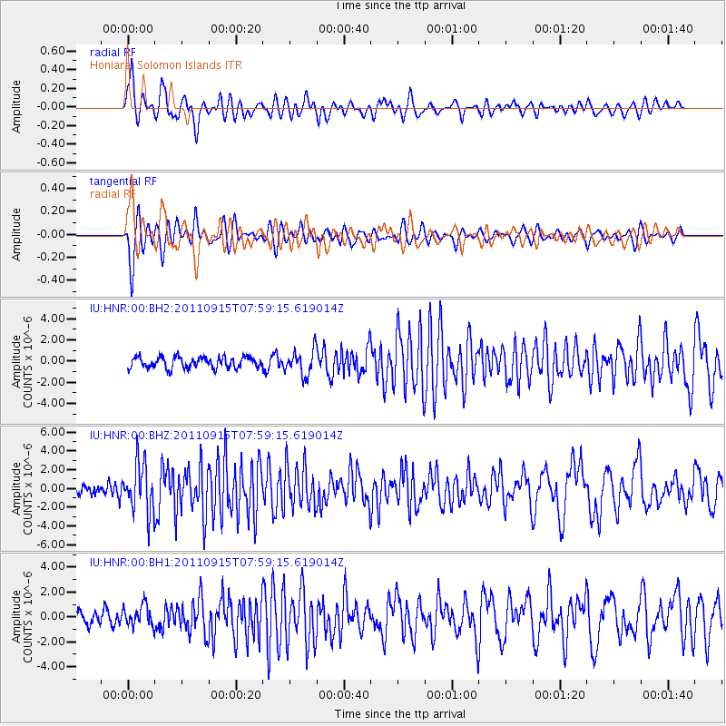
HNR Honiara, Solomon Islands - Earthquake Result Viewer
*The percent match for this event was below the threshold and hence no stack was calculated.
| Earthquake location: |
East Of North Island, N.Z. |
| Earthquake latitude/longitude: |
-35.4/-179.0 |
| Earthquake time(UTC): |
2011/09/15 (258) 07:53:18 GMT |
| Earthquake Depth: |
10 km |
| Earthquake Magnitude: |
6.0 MB, 6.2 MS, 6.1 MW, 6.0 MW |
| Earthquake Catalog/Contributor: |
WHDF/NEIC |
|
| Network: |
IU Global Seismograph Network (GSN - IRIS/USGS) |
| Station: |
HNR Honiara, Solomon Islands |
| Lat/Lon: |
9.44 S/159.95 E |
| Elevation: |
100 m |
|
| Distance: |
32.2 deg |
| Az: |
318.333 deg |
| Baz: |
146.585 deg |
| Ray Param: |
$rayparam |
*The percent match for this event was below the threshold and hence was not used in the summary stack. |
|
| Radial Match: |
70.06426 % |
| Radial Bump: |
400 |
| Transverse Match: |
69.8095 % |
| Transverse Bump: |
400 |
| SOD ConfigId: |
558545 |
| Insert Time: |
2013-09-19 02:54:04.711 +0000 |
| GWidth: |
2.5 |
| Max Bumps: |
400 |
| Tol: |
0.001 |
|
Signal To Noise
| Channel | StoN | STA | LTA |
| IU:HNR:00:BHZ:20110915T07:59:15.619014Z | 4.767219 | 2.660959E-6 | 5.5817844E-7 |
| IU:HNR:00:BH1:20110915T07:59:15.619014Z | 1.3800373 | 8.4226485E-7 | 6.1032034E-7 |
| IU:HNR:00:BH2:20110915T07:59:15.619014Z | 2.3139129 | 1.1884138E-6 | 5.135949E-7 |
| Arrivals |
| Ps | |
| PpPs | |
| PsPs/PpSs | |


