You are here: Home > Network List > US - United States National Seismic Network Stations List
> Station MNTX Cornudas Mountains, Texas, USA > Earthquake Result Viewer
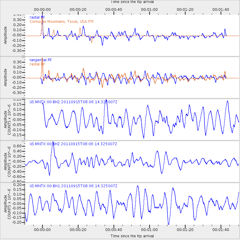
MNTX Cornudas Mountains, Texas, USA - Earthquake Result Viewer
*The percent match for this event was below the threshold and hence no stack was calculated.
| Earthquake location: |
East Of North Island, N.Z. |
| Earthquake latitude/longitude: |
-35.4/-179.0 |
| Earthquake time(UTC): |
2011/09/15 (258) 07:53:18 GMT |
| Earthquake Depth: |
10 km |
| Earthquake Magnitude: |
6.0 MB, 6.2 MS, 6.1 MW, 6.0 MW |
| Earthquake Catalog/Contributor: |
WHDF/NEIC |
|
| Network: |
US United States National Seismic Network |
| Station: |
MNTX Cornudas Mountains, Texas, USA |
| Lat/Lon: |
31.70 N/105.38 W |
| Elevation: |
404 m |
|
| Distance: |
96.0 deg |
| Az: |
55.338 deg |
| Baz: |
232.06 deg |
| Ray Param: |
$rayparam |
*The percent match for this event was below the threshold and hence was not used in the summary stack. |
|
| Radial Match: |
65.91669 % |
| Radial Bump: |
332 |
| Transverse Match: |
53.38299 % |
| Transverse Bump: |
394 |
| SOD ConfigId: |
558545 |
| Insert Time: |
2013-09-19 02:54:45.963 +0000 |
| GWidth: |
2.5 |
| Max Bumps: |
400 |
| Tol: |
0.001 |
|
Signal To Noise
| Channel | StoN | STA | LTA |
| US:MNTX:00:BHZ:20110915T08:06:14.325007Z | 3.5636363 | 2.1700015E-7 | 6.08929E-8 |
| US:MNTX:00:BH1:20110915T08:06:14.325007Z | 0.49718758 | 4.2163915E-8 | 8.480484E-8 |
| US:MNTX:00:BH2:20110915T08:06:14.325007Z | 1.2187796 | 8.051468E-8 | 6.606173E-8 |
| Arrivals |
| Ps | |
| PpPs | |
| PsPs/PpSs | |


