You are here: Home > Network List > US - United States National Seismic Network Stations List
> Station TPNV Topopah Spring, Nevada, USA > Earthquake Result Viewer
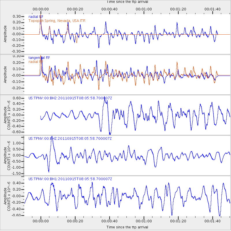
TPNV Topopah Spring, Nevada, USA - Earthquake Result Viewer
*The percent match for this event was below the threshold and hence no stack was calculated.
| Earthquake location: |
East Of North Island, N.Z. |
| Earthquake latitude/longitude: |
-35.4/-179.0 |
| Earthquake time(UTC): |
2011/09/15 (258) 07:53:18 GMT |
| Earthquake Depth: |
10 km |
| Earthquake Magnitude: |
6.0 MB, 6.2 MS, 6.1 MW, 6.0 MW |
| Earthquake Catalog/Contributor: |
WHDF/NEIC |
|
| Network: |
US United States National Seismic Network |
| Station: |
TPNV Topopah Spring, Nevada, USA |
| Lat/Lon: |
36.95 N/116.25 W |
| Elevation: |
1600 m |
|
| Distance: |
92.6 deg |
| Az: |
45.495 deg |
| Baz: |
226.686 deg |
| Ray Param: |
$rayparam |
*The percent match for this event was below the threshold and hence was not used in the summary stack. |
|
| Radial Match: |
68.840645 % |
| Radial Bump: |
400 |
| Transverse Match: |
82.44226 % |
| Transverse Bump: |
400 |
| SOD ConfigId: |
558545 |
| Insert Time: |
2013-09-19 02:54:52.028 +0000 |
| GWidth: |
2.5 |
| Max Bumps: |
400 |
| Tol: |
0.001 |
|
Signal To Noise
| Channel | StoN | STA | LTA |
| US:TPNV:00:BHZ:20110915T08:05:58.700007Z | 2.620631 | 4.3878026E-7 | 1.6743306E-7 |
| US:TPNV:00:BH1:20110915T08:05:58.700007Z | 0.91890186 | 1.7523864E-7 | 1.9070441E-7 |
| US:TPNV:00:BH2:20110915T08:05:58.700007Z | 1.8321017 | 1.6746057E-7 | 9.140353E-8 |
| Arrivals |
| Ps | |
| PpPs | |
| PsPs/PpSs | |


