You are here: Home > Network List > US - United States National Seismic Network Stations List
> Station AMTX Amarillo, Texas, USA > Earthquake Result Viewer
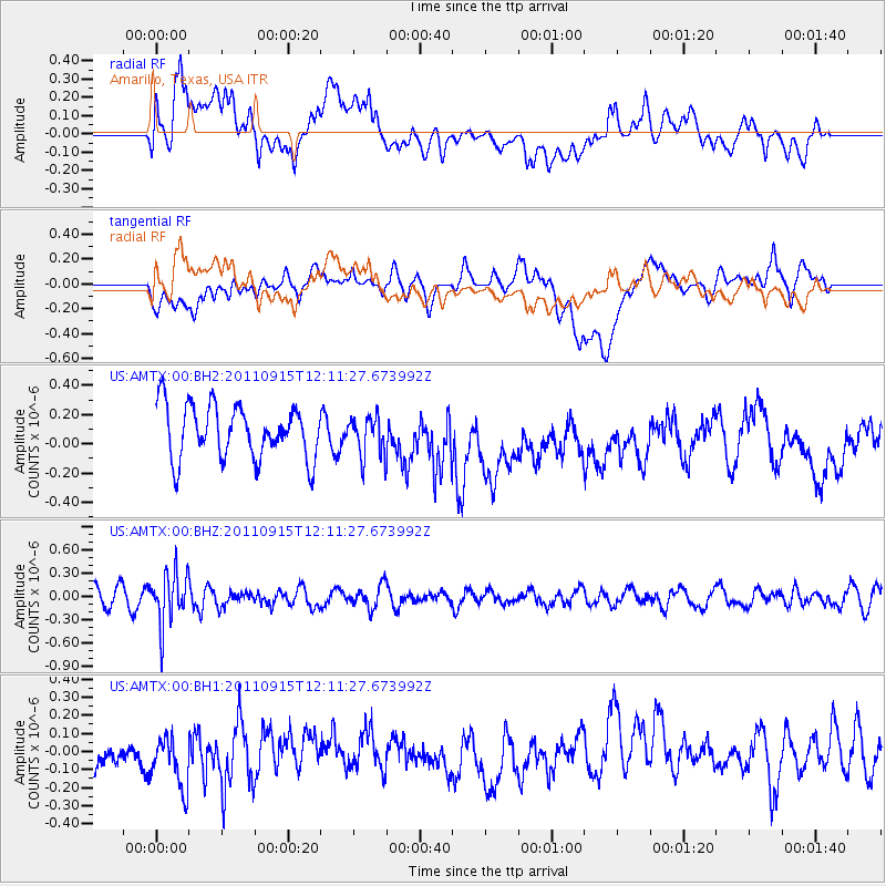
AMTX Amarillo, Texas, USA - Earthquake Result Viewer
*The percent match for this event was below the threshold and hence no stack was calculated.
| Earthquake location: |
Fiji Islands Region |
| Earthquake latitude/longitude: |
-15.0/-178.0 |
| Earthquake time(UTC): |
2011/09/15 (258) 11:59:52 GMT |
| Earthquake Depth: |
378 km |
| Earthquake Magnitude: |
5.6 MB, 5.6 MW, 5.5 MW |
| Earthquake Catalog/Contributor: |
WHDF/NEIC |
|
| Network: |
US United States National Seismic Network |
| Station: |
AMTX Amarillo, Texas, USA |
| Lat/Lon: |
34.53 N/101.41 W |
| Elevation: |
1010 m |
|
| Distance: |
87.7 deg |
| Az: |
53.478 deg |
| Baz: |
250.191 deg |
| Ray Param: |
$rayparam |
*The percent match for this event was below the threshold and hence was not used in the summary stack. |
|
| Radial Match: |
37.031555 % |
| Radial Bump: |
400 |
| Transverse Match: |
42.10713 % |
| Transverse Bump: |
400 |
| SOD ConfigId: |
558545 |
| Insert Time: |
2013-09-19 02:59:19.254 +0000 |
| GWidth: |
2.5 |
| Max Bumps: |
400 |
| Tol: |
0.001 |
|
Signal To Noise
| Channel | StoN | STA | LTA |
| US:AMTX:00:BHZ:20110915T12:11:27.673992Z | 2.1037517 | 3.3213865E-7 | 1.5787921E-7 |
| US:AMTX:00:BH1:20110915T12:11:27.673992Z | 0.87520546 | 2.1124248E-7 | 2.413633E-7 |
| US:AMTX:00:BH2:20110915T12:11:27.673992Z | 0.8160077 | 1.4669678E-7 | 1.7977376E-7 |
| Arrivals |
| Ps | |
| PpPs | |
| PsPs/PpSs | |


