You are here: Home > Network List > CN - Canadian National Seismograph Network Stations List
> Station INK INUVIK, NT, CANADA.ANADA > Earthquake Result Viewer
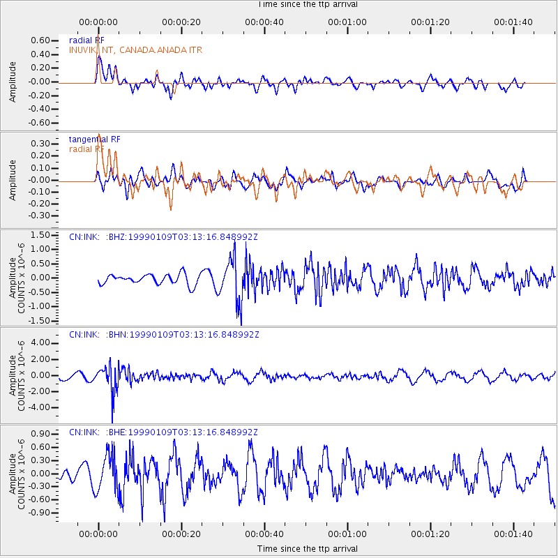
INK INUVIK, NT, CANADA.ANADA - Earthquake Result Viewer
*The percent match for this event was below the threshold and hence no stack was calculated.
| Earthquake location: |
Kuril Islands |
| Earthquake latitude/longitude: |
44.4/147.3 |
| Earthquake time(UTC): |
1999/01/09 (009) 03:05:37 GMT |
| Earthquake Depth: |
119 km |
| Earthquake Magnitude: |
5.8 MB, 5.8 MW, 5.6 MW |
| Earthquake Catalog/Contributor: |
WHDF/NEIC |
|
| Network: |
CN Canadian National Seismograph Network |
| Station: |
INK INUVIK, NT, CANADA.ANADA |
| Lat/Lon: |
68.31 N/133.52 W |
| Elevation: |
40 m |
|
| Distance: |
45.8 deg |
| Az: |
30.625 deg |
| Baz: |
280.782 deg |
| Ray Param: |
$rayparam |
*The percent match for this event was below the threshold and hence was not used in the summary stack. |
|
| Radial Match: |
66.27461 % |
| Radial Bump: |
400 |
| Transverse Match: |
45.028778 % |
| Transverse Bump: |
400 |
| SOD ConfigId: |
4480 |
| Insert Time: |
2010-02-27 06:25:18.469 +0000 |
| GWidth: |
2.5 |
| Max Bumps: |
400 |
| Tol: |
0.001 |
|
Signal To Noise
| Channel | StoN | STA | LTA |
| CN:INK: :BHN:19990109T03:13:16.848992Z | 5.206435 | 1.5947659E-6 | 3.0630667E-7 |
| CN:INK: :BHE:19990109T03:13:16.848992Z | 2.2278407 | 4.192502E-7 | 1.8818679E-7 |
| CN:INK: :BHZ:19990109T03:13:16.848992Z | 4.2769246 | 7.530087E-7 | 1.7606311E-7 |
| Arrivals |
| Ps | |
| PpPs | |
| PsPs/PpSs | |


