You are here: Home > Network List > IU - Global Seismograph Network (GSN - IRIS/USGS) Stations List
> Station JOHN Johnston Island, USA > Earthquake Result Viewer
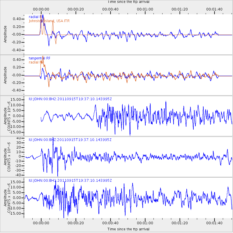
JOHN Johnston Island, USA - Earthquake Result Viewer
*The percent match for this event was below the threshold and hence no stack was calculated.
| Earthquake location: |
Fiji Islands Region |
| Earthquake latitude/longitude: |
-21.6/-179.5 |
| Earthquake time(UTC): |
2011/09/15 (258) 19:31:04 GMT |
| Earthquake Depth: |
645 km |
| Earthquake Magnitude: |
6.1 MB, 7.3 MW, 7.3 MW |
| Earthquake Catalog/Contributor: |
WHDF/NEIC |
|
| Network: |
IU Global Seismograph Network (GSN - IRIS/USGS) |
| Station: |
JOHN Johnston Island, USA |
| Lat/Lon: |
16.73 N/169.53 W |
| Elevation: |
2.0 m |
|
| Distance: |
39.3 deg |
| Az: |
15.213 deg |
| Baz: |
194.764 deg |
| Ray Param: |
$rayparam |
*The percent match for this event was below the threshold and hence was not used in the summary stack. |
|
| Radial Match: |
79.36171 % |
| Radial Bump: |
400 |
| Transverse Match: |
64.643105 % |
| Transverse Bump: |
400 |
| SOD ConfigId: |
558545 |
| Insert Time: |
2013-09-19 03:01:36.244 +0000 |
| GWidth: |
2.5 |
| Max Bumps: |
400 |
| Tol: |
0.001 |
|
Signal To Noise
| Channel | StoN | STA | LTA |
| IU:JOHN:00:BHZ:20110915T19:37:10.143995Z | 8.730143 | 1.350032E-5 | 1.5464033E-6 |
| IU:JOHN:00:BH1:20110915T19:37:10.143995Z | 2.278988 | 4.321801E-6 | 1.8963688E-6 |
| IU:JOHN:00:BH2:20110915T19:37:10.143995Z | 2.3946562 | 5.2633877E-6 | 2.1979722E-6 |
| Arrivals |
| Ps | |
| PpPs | |
| PsPs/PpSs | |


