You are here: Home > Network List > IU - Global Seismograph Network (GSN - IRIS/USGS) Stations List
> Station MAJO Matsushiro, Japan > Earthquake Result Viewer
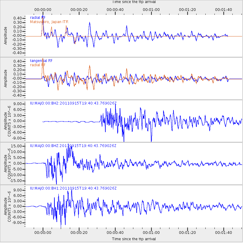
MAJO Matsushiro, Japan - Earthquake Result Viewer
*The percent match for this event was below the threshold and hence no stack was calculated.
| Earthquake location: |
Fiji Islands Region |
| Earthquake latitude/longitude: |
-21.6/-179.5 |
| Earthquake time(UTC): |
2011/09/15 (258) 19:31:04 GMT |
| Earthquake Depth: |
645 km |
| Earthquake Magnitude: |
6.1 MB, 7.3 MW, 7.3 MW |
| Earthquake Catalog/Contributor: |
WHDF/NEIC |
|
| Network: |
IU Global Seismograph Network (GSN - IRIS/USGS) |
| Station: |
MAJO Matsushiro, Japan |
| Lat/Lon: |
36.55 N/138.20 E |
| Elevation: |
405 m |
|
| Distance: |
70.3 deg |
| Az: |
324.873 deg |
| Baz: |
138.327 deg |
| Ray Param: |
$rayparam |
*The percent match for this event was below the threshold and hence was not used in the summary stack. |
|
| Radial Match: |
79.85991 % |
| Radial Bump: |
400 |
| Transverse Match: |
87.61578 % |
| Transverse Bump: |
400 |
| SOD ConfigId: |
558545 |
| Insert Time: |
2013-09-19 03:01:41.338 +0000 |
| GWidth: |
2.5 |
| Max Bumps: |
400 |
| Tol: |
0.001 |
|
Signal To Noise
| Channel | StoN | STA | LTA |
| IU:MAJO:00:BHZ:20110915T19:40:43.769026Z | 22.134819 | 4.3981513E-6 | 1.9869832E-7 |
| IU:MAJO:00:BH1:20110915T19:40:43.769026Z | 10.763889 | 1.7145419E-6 | 1.5928646E-7 |
| IU:MAJO:00:BH2:20110915T19:40:43.769026Z | 10.344484 | 1.6997326E-6 | 1.6431294E-7 |
| Arrivals |
| Ps | |
| PpPs | |
| PsPs/PpSs | |


