You are here: Home > Network List > US - United States National Seismic Network Stations List
> Station EGMT Eagleton, Montana, USA > Earthquake Result Viewer
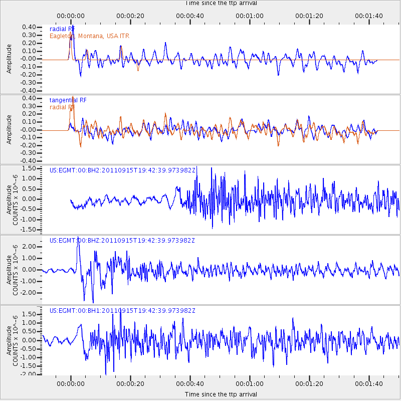
EGMT Eagleton, Montana, USA - Earthquake Result Viewer
*The percent match for this event was below the threshold and hence no stack was calculated.
| Earthquake location: |
Fiji Islands Region |
| Earthquake latitude/longitude: |
-21.6/-179.5 |
| Earthquake time(UTC): |
2011/09/15 (258) 19:31:04 GMT |
| Earthquake Depth: |
645 km |
| Earthquake Magnitude: |
6.1 MB, 7.3 MW, 7.3 MW |
| Earthquake Catalog/Contributor: |
WHDF/NEIC |
|
| Network: |
US United States National Seismic Network |
| Station: |
EGMT Eagleton, Montana, USA |
| Lat/Lon: |
48.02 N/109.75 W |
| Elevation: |
1055 m |
|
| Distance: |
93.2 deg |
| Az: |
39.114 deg |
| Baz: |
240.987 deg |
| Ray Param: |
$rayparam |
*The percent match for this event was below the threshold and hence was not used in the summary stack. |
|
| Radial Match: |
73.77566 % |
| Radial Bump: |
400 |
| Transverse Match: |
50.950996 % |
| Transverse Bump: |
400 |
| SOD ConfigId: |
558545 |
| Insert Time: |
2013-09-19 03:02:29.004 +0000 |
| GWidth: |
2.5 |
| Max Bumps: |
400 |
| Tol: |
0.001 |
|
Signal To Noise
| Channel | StoN | STA | LTA |
| US:EGMT:00:BHZ:20110915T19:42:39.973982Z | 13.701893 | 1.2410287E-6 | 9.057352E-8 |
| US:EGMT:00:BH1:20110915T19:42:39.973982Z | 2.9942837 | 5.1002183E-7 | 1.7033183E-7 |
| US:EGMT:00:BH2:20110915T19:42:39.973982Z | 1.2853873 | 2.0338777E-7 | 1.5823073E-7 |
| Arrivals |
| Ps | |
| PpPs | |
| PsPs/PpSs | |


