AAK Ala Archa, Kyrgyzstan - Earthquake Result Viewer
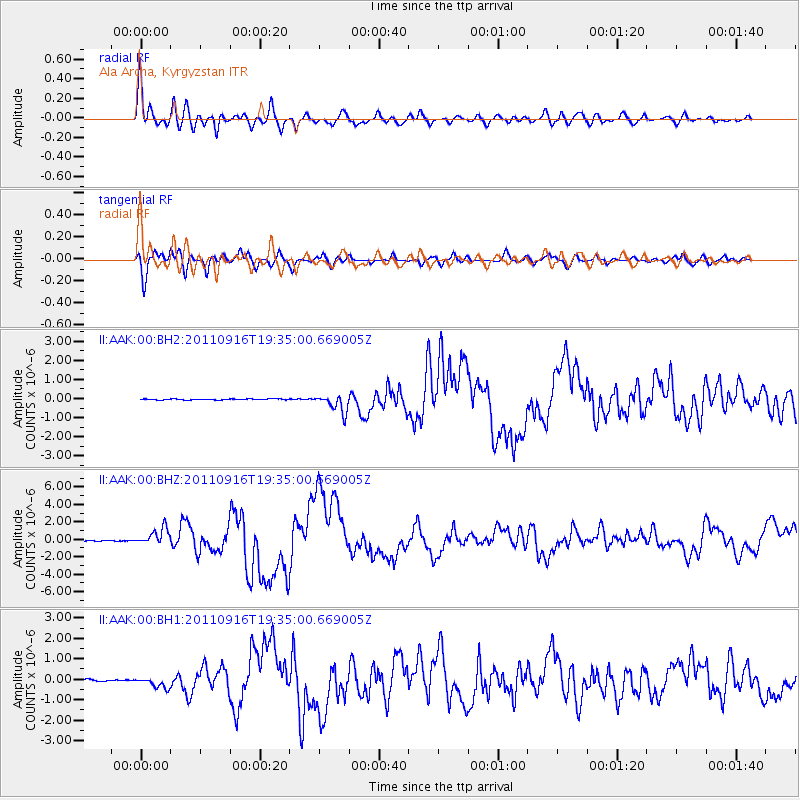
Earthquake location: Near East Coast Of Honshu, Japan
Earthquake latitude/longitude: 40.3/142.8
Earthquake time(UTC): 2011/09/16 (259) 19:26:40 GMT
Earthquake Depth: 35 km
Earthquake Magnitude: 6.0 MB, 6.5 MS, 6.7 MW, 6.7 MW
Earthquake Catalog/Contributor: WHDF/NEIC
Network: II Global Seismograph Network (GSN - IRIS/IDA)
Station: AAK Ala Archa, Kyrgyzstan
Lat/Lon: 42.64 N/74.49 E
Elevation: 1645 m
Distance: 50.0 deg
Az: 296.421 deg
Baz: 68.218 deg
Ray Param: 0.068306506
Estimated Moho Depth: 50.0 km
Estimated Crust Vp/Vs: 1.94
Assumed Crust Vp: 6.306 km/s
Estimated Crust Vs: 3.251 km/s
Estimated Crust Poisson's Ratio: 0.32
Radial Match: 93.84567 %
Radial Bump: 400
Transverse Match: 89.765976 %
Transverse Bump: 400
SOD ConfigId: 558545
Insert Time: 2013-09-19 03:05:19.150 +0000
GWidth: 2.5
Max Bumps: 400
Tol: 0.001

Signal To Noise

ChannelStoNSTALTA
II:AAK:00:BHZ:20110916T19:35:00.669005Z27.080089.65062E-73.563734E-8
II:AAK:00:BH1:20110916T19:35:00.669005Z7.16052342.651505E-73.7029483E-8
II:AAK:00:BH2:20110916T19:35:00.669005Z17.1981324.693516E-72.729085E-8
Arrivals
Ps7.8 SECOND
PpPs22 SECOND
PsPs/PpSs30 SECOND