GNI Garni, Armenia - Earthquake Result Viewer
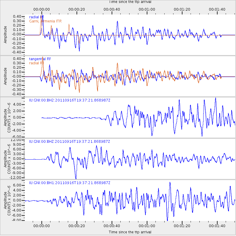
Earthquake location: Near East Coast Of Honshu, Japan
Earthquake latitude/longitude: 40.3/142.8
Earthquake time(UTC): 2011/09/16 (259) 19:26:40 GMT
Earthquake Depth: 35 km
Earthquake Magnitude: 6.0 MB, 6.5 MS, 6.7 MW, 6.7 MW
Earthquake Catalog/Contributor: WHDF/NEIC
Network: IU Global Seismograph Network (GSN - IRIS/USGS)
Station: GNI Garni, Armenia
Lat/Lon: 40.15 N/44.74 E
Elevation: 1609 m
Distance: 70.6 deg
Az: 306.441 deg
Baz: 53.419 deg
Ray Param: 0.05479439
Estimated Moho Depth: 10.5 km
Estimated Crust Vp/Vs: 1.60
Assumed Crust Vp: 6.291 km/s
Estimated Crust Vs: 3.932 km/s
Estimated Crust Poisson's Ratio: 0.18
Radial Match: 84.876915 %
Radial Bump: 400
Transverse Match: 83.39912 %
Transverse Bump: 400
SOD ConfigId: 558545
Insert Time: 2013-09-19 03:05:52.114 +0000
GWidth: 2.5
Max Bumps: 400
Tol: 0.001

Signal To Noise

ChannelStoNSTALTA
IU:GNI:00:BHZ:20110916T19:37:21.868987Z8.7976056.900322E-77.8434105E-8
IU:GNI:00:BH1:20110916T19:37:21.868987Z2.24121761.667602E-77.440607E-8
IU:GNI:00:BH2:20110916T19:37:21.868987Z2.26297432.1190824E-79.3641475E-8
Arrivals
Ps1.0 SECOND
PpPs4.2 SECOND
PsPs/PpSs5.2 SECOND