KEV Kevo, Finland - Earthquake Result Viewer
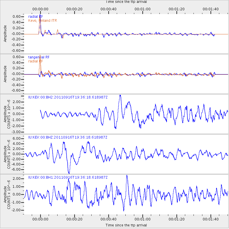
Earthquake location: Near East Coast Of Honshu, Japan
Earthquake latitude/longitude: 40.3/142.8
Earthquake time(UTC): 2011/09/16 (259) 19:26:40 GMT
Earthquake Depth: 35 km
Earthquake Magnitude: 6.0 MB, 6.5 MS, 6.7 MW, 6.7 MW
Earthquake Catalog/Contributor: WHDF/NEIC
Network: IU Global Seismograph Network (GSN - IRIS/USGS)
Station: KEV Kevo, Finland
Lat/Lon: 69.76 N/27.00 E
Elevation: 100 m
Distance: 60.8 deg
Az: 338.959 deg
Baz: 52.118 deg
Ray Param: 0.06122894
Estimated Moho Depth: 34.75 km
Estimated Crust Vp/Vs: 1.92
Assumed Crust Vp: 6.622 km/s
Estimated Crust Vs: 3.449 km/s
Estimated Crust Poisson's Ratio: 0.31
Radial Match: 94.31463 %
Radial Bump: 301
Transverse Match: 77.03581 %
Transverse Bump: 400
SOD ConfigId: 558545
Insert Time: 2013-09-19 03:06:03.051 +0000
GWidth: 2.5
Max Bumps: 400
Tol: 0.001

Signal To Noise

ChannelStoNSTALTA
IU:KEV:00:BHZ:20110916T19:36:18.618987Z3.31452541.0056737E-63.0341408E-7
IU:KEV:00:BH1:20110916T19:36:18.618987Z1.23854893.0101037E-72.4303472E-7
IU:KEV:00:BH2:20110916T19:36:18.618987Z2.02546955.25322E-72.5935813E-7
Arrivals
Ps5.1 SECOND
PpPs15 SECOND
PsPs/PpSs20 SECOND