You are here: Home > Network List > CN - Canadian National Seismograph Network Stations List
> Station INK INUVIK, NT, CANADA.ANADA > Earthquake Result Viewer
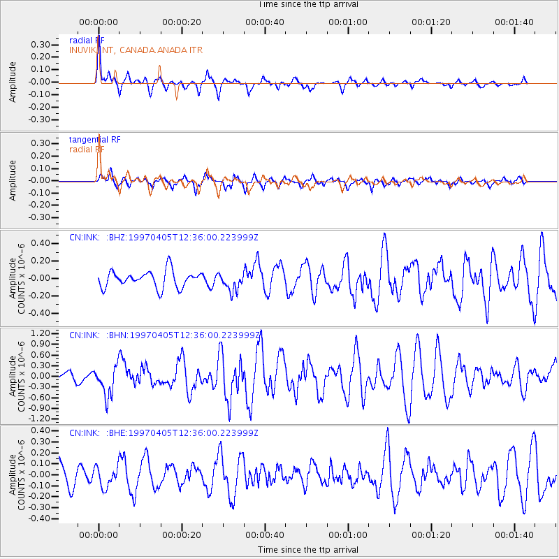
INK INUVIK, NT, CANADA.ANADA - Earthquake Result Viewer
*The percent match for this event was below the threshold and hence no stack was calculated.
| Earthquake location: |
Eastern New Guinea Reg., P.N.G. |
| Earthquake latitude/longitude: |
-6.5/147.4 |
| Earthquake time(UTC): |
1997/04/05 (095) 12:23:30 GMT |
| Earthquake Depth: |
69 km |
| Earthquake Magnitude: |
6.1 MB, 6.5 UNKNOWN, 6.4 MW |
| Earthquake Catalog/Contributor: |
WHDF/NEIC |
|
| Network: |
CN Canadian National Seismograph Network |
| Station: |
INK INUVIK, NT, CANADA.ANADA |
| Lat/Lon: |
68.31 N/133.52 W |
| Elevation: |
40 m |
|
| Distance: |
92.0 deg |
| Az: |
21.423 deg |
| Baz: |
257.484 deg |
| Ray Param: |
$rayparam |
*The percent match for this event was below the threshold and hence was not used in the summary stack. |
|
| Radial Match: |
75.628296 % |
| Radial Bump: |
400 |
| Transverse Match: |
67.37059 % |
| Transverse Bump: |
400 |
| SOD ConfigId: |
4480 |
| Insert Time: |
2010-02-27 06:25:33.970 +0000 |
| GWidth: |
2.5 |
| Max Bumps: |
400 |
| Tol: |
0.001 |
|
Signal To Noise
| Channel | StoN | STA | LTA |
| CN:INK: :BHN:19970405T12:36:00.223999Z | 2.195083 | 4.336221E-7 | 1.9754246E-7 |
| CN:INK: :BHE:19970405T12:36:00.223999Z | 0.62474185 | 9.605852E-8 | 1.5375713E-7 |
| CN:INK: :BHZ:19970405T12:36:00.223999Z | 1.0952957 | 1.0586196E-7 | 9.665149E-8 |
| Arrivals |
| Ps | |
| PpPs | |
| PsPs/PpSs | |


