You are here: Home > Network List > CN - Canadian National Seismograph Network Stations List
> Station INK INUVIK, NT, CANADA.ANADA > Earthquake Result Viewer
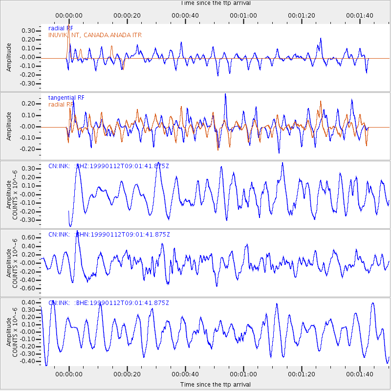
INK INUVIK, NT, CANADA.ANADA - Earthquake Result Viewer
*The percent match for this event was below the threshold and hence no stack was calculated.
| Earthquake location: |
New Britain Region, P.N.G. |
| Earthquake latitude/longitude: |
-5.4/151.7 |
| Earthquake time(UTC): |
1999/01/12 (012) 08:49:20 GMT |
| Earthquake Depth: |
43 km |
| Earthquake Magnitude: |
5.5 MB, 5.9 MS, 6.0 MW, 5.9 MW |
| Earthquake Catalog/Contributor: |
WHDF/NEIC |
|
| Network: |
CN Canadian National Seismograph Network |
| Station: |
INK INUVIK, NT, CANADA.ANADA |
| Lat/Lon: |
68.31 N/133.52 W |
| Elevation: |
40 m |
|
| Distance: |
89.4 deg |
| Az: |
21.026 deg |
| Baz: |
253.904 deg |
| Ray Param: |
$rayparam |
*The percent match for this event was below the threshold and hence was not used in the summary stack. |
|
| Radial Match: |
36.78291 % |
| Radial Bump: |
387 |
| Transverse Match: |
66.95784 % |
| Transverse Bump: |
400 |
| SOD ConfigId: |
4480 |
| Insert Time: |
2010-02-27 06:25:35.901 +0000 |
| GWidth: |
2.5 |
| Max Bumps: |
400 |
| Tol: |
0.001 |
|
Signal To Noise
| Channel | StoN | STA | LTA |
| CN:INK: :BHN:19990112T09:01:41.875Z | 2.6621897 | 3.7260207E-7 | 1.3996076E-7 |
| CN:INK: :BHE:19990112T09:01:41.875Z | 0.5925066 | 1.2428387E-7 | 2.0975949E-7 |
| CN:INK: :BHZ:19990112T09:01:41.875Z | 1.5930704 | 2.2467574E-7 | 1.4103315E-7 |
| Arrivals |
| Ps | |
| PpPs | |
| PsPs/PpSs | |


