You are here: Home > Network List > CN - Canadian National Seismograph Network Stations List
> Station INK INUVIK, NT, CANADA.ANADA > Earthquake Result Viewer
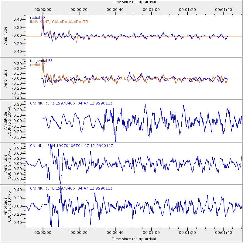
INK INUVIK, NT, CANADA.ANADA - Earthquake Result Viewer
*The percent match for this event was below the threshold and hence no stack was calculated.
| Earthquake location: |
Southern Xinjiang, China |
| Earthquake latitude/longitude: |
39.5/77.0 |
| Earthquake time(UTC): |
1997/04/06 (096) 04:36:35 GMT |
| Earthquake Depth: |
33 km |
| Earthquake Magnitude: |
5.6 MB, 5.8 MS, 5.9 UNKNOWN, 5.9 MW |
| Earthquake Catalog/Contributor: |
WHDF/NEIC |
|
| Network: |
CN Canadian National Seismograph Network |
| Station: |
INK INUVIK, NT, CANADA.ANADA |
| Lat/Lon: |
68.31 N/133.52 W |
| Elevation: |
40 m |
|
| Distance: |
70.1 deg |
| Az: |
11.585 deg |
| Baz: |
335.31 deg |
| Ray Param: |
$rayparam |
*The percent match for this event was below the threshold and hence was not used in the summary stack. |
|
| Radial Match: |
65.897156 % |
| Radial Bump: |
400 |
| Transverse Match: |
57.387497 % |
| Transverse Bump: |
400 |
| SOD ConfigId: |
4480 |
| Insert Time: |
2010-02-27 06:25:36.636 +0000 |
| GWidth: |
2.5 |
| Max Bumps: |
400 |
| Tol: |
0.001 |
|
Signal To Noise
| Channel | StoN | STA | LTA |
| CN:INK: :BHN:19970406T04:47:12.999011Z | 5.0697 | 4.9990217E-7 | 9.8605874E-8 |
| CN:INK: :BHE:19970406T04:47:12.999011Z | 2.2223694 | 1.852064E-7 | 8.333736E-8 |
| CN:INK: :BHZ:19970406T04:47:12.999011Z | 1.0282785 | 8.403106E-8 | 8.172014E-8 |
| Arrivals |
| Ps | |
| PpPs | |
| PsPs/PpSs | |


