You are here: Home > Network List > US - United States National Seismic Network Stations List
> Station AMTX Amarillo, Texas, USA > Earthquake Result Viewer
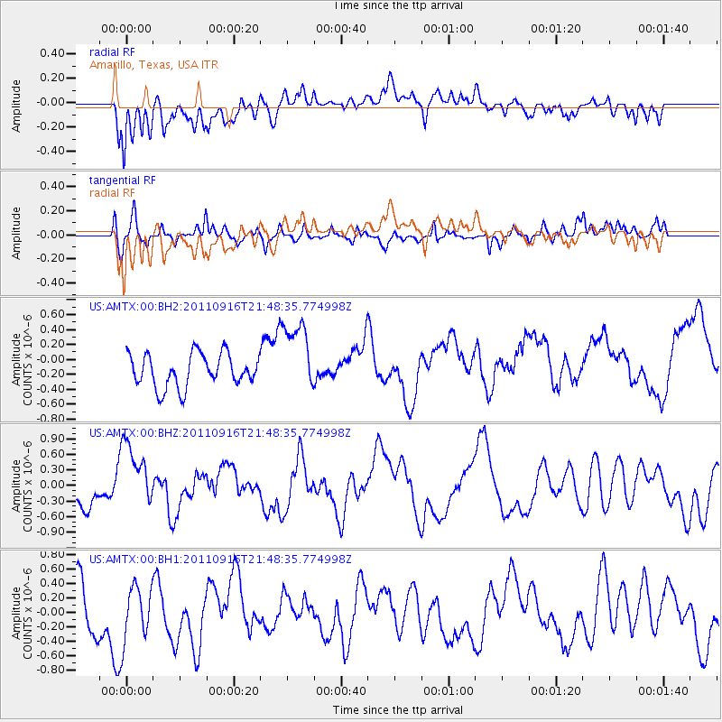
AMTX Amarillo, Texas, USA - Earthquake Result Viewer
*The percent match for this event was below the threshold and hence no stack was calculated.
| Earthquake location: |
Off East Coast Of Honshu, Japan |
| Earthquake latitude/longitude: |
40.1/143.1 |
| Earthquake time(UTC): |
2011/09/16 (259) 21:36:38 GMT |
| Earthquake Depth: |
41 km |
| Earthquake Magnitude: |
5.8 MW, 5.6 MS, 5.6 MB |
| Earthquake Catalog/Contributor: |
NEIC PDE/NEIC PDE-M |
|
| Network: |
US United States National Seismic Network |
| Station: |
AMTX Amarillo, Texas, USA |
| Lat/Lon: |
34.53 N/101.41 W |
| Elevation: |
1010 m |
|
| Distance: |
84.9 deg |
| Az: |
48.465 deg |
| Baz: |
315.917 deg |
| Ray Param: |
$rayparam |
*The percent match for this event was below the threshold and hence was not used in the summary stack. |
|
| Radial Match: |
59.558853 % |
| Radial Bump: |
400 |
| Transverse Match: |
54.420624 % |
| Transverse Bump: |
400 |
| SOD ConfigId: |
558545 |
| Insert Time: |
2013-09-19 03:13:53.391 +0000 |
| GWidth: |
2.5 |
| Max Bumps: |
400 |
| Tol: |
0.001 |
|
Signal To Noise
| Channel | StoN | STA | LTA |
| US:AMTX:00:BHZ:20110916T21:48:35.774998Z | 2.4267285 | 6.615494E-7 | 2.7260955E-7 |
| US:AMTX:00:BH1:20110916T21:48:35.774998Z | 1.0659934 | 3.7306464E-7 | 3.49969E-7 |
| US:AMTX:00:BH2:20110916T21:48:35.774998Z | 1.5955015 | 3.8726995E-7 | 2.4272617E-7 |
| Arrivals |
| Ps | |
| PpPs | |
| PsPs/PpSs | |


