You are here: Home > Network List > II - Global Seismograph Network (GSN - IRIS/IDA) Stations List
> Station WRAB Tennant Creek, NT, Australia > Earthquake Result Viewer
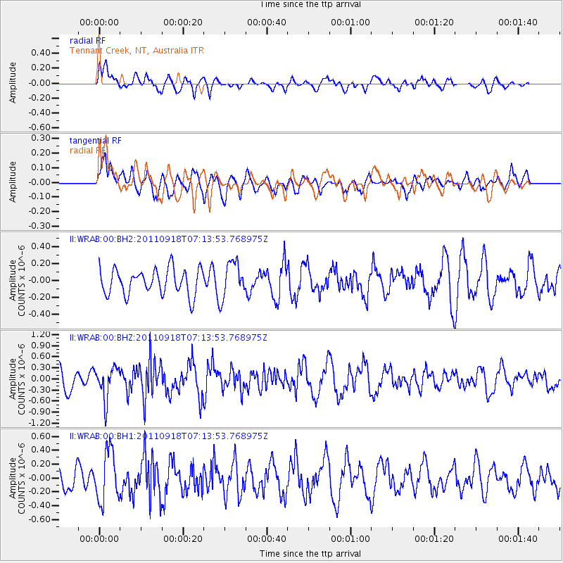
WRAB Tennant Creek, NT, Australia - Earthquake Result Viewer
*The percent match for this event was below the threshold and hence no stack was calculated.
| Earthquake location: |
Off East Coast Of Honshu, Japan |
| Earthquake latitude/longitude: |
39.8/143.1 |
| Earthquake time(UTC): |
2011/09/18 (261) 07:04:18 GMT |
| Earthquake Depth: |
10 km |
| Earthquake Magnitude: |
5.6 MW, 5.5 MB, 5.6 MW |
| Earthquake Catalog/Contributor: |
NEIC PDE/NEIC PDE-M |
|
| Network: |
II Global Seismograph Network (GSN - IRIS/IDA) |
| Station: |
WRAB Tennant Creek, NT, Australia |
| Lat/Lon: |
19.93 S/134.36 E |
| Elevation: |
366 m |
|
| Distance: |
60.0 deg |
| Az: |
189.448 deg |
| Baz: |
7.719 deg |
| Ray Param: |
$rayparam |
*The percent match for this event was below the threshold and hence was not used in the summary stack. |
|
| Radial Match: |
64.394165 % |
| Radial Bump: |
400 |
| Transverse Match: |
50.041523 % |
| Transverse Bump: |
400 |
| SOD ConfigId: |
558545 |
| Insert Time: |
2013-09-19 03:20:57.226 +0000 |
| GWidth: |
2.5 |
| Max Bumps: |
400 |
| Tol: |
0.001 |
|
Signal To Noise
| Channel | StoN | STA | LTA |
| II:WRAB:00:BHZ:20110918T07:13:53.768975Z | 1.9323114 | 4.363712E-7 | 2.2582861E-7 |
| II:WRAB:00:BH1:20110918T07:13:53.768975Z | 2.9355757 | 3.7326072E-7 | 1.2715077E-7 |
| II:WRAB:00:BH2:20110918T07:13:53.768975Z | 1.3681557 | 2.075135E-7 | 1.5167389E-7 |
| Arrivals |
| Ps | |
| PpPs | |
| PsPs/PpSs | |


