You are here: Home > Network List > CN - Canadian National Seismograph Network Stations List
> Station INK INUVIK, NT, CANADA.ANADA > Earthquake Result Viewer
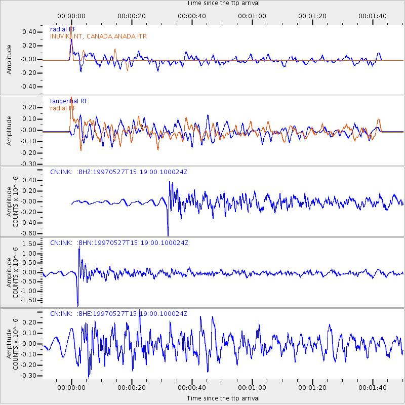
INK INUVIK, NT, CANADA.ANADA - Earthquake Result Viewer
*The percent match for this event was below the threshold and hence no stack was calculated.
| Earthquake location: |
Mariana Islands |
| Earthquake latitude/longitude: |
16.3/145.4 |
| Earthquake time(UTC): |
1997/05/27 (147) 15:09:03 GMT |
| Earthquake Depth: |
536 km |
| Earthquake Magnitude: |
5.5 MB, 5.6 UNKNOWN, 5.6 MW |
| Earthquake Catalog/Contributor: |
WHDF/NEIC |
|
| Network: |
CN Canadian National Seismograph Network |
| Station: |
INK INUVIK, NT, CANADA.ANADA |
| Lat/Lon: |
68.31 N/133.52 W |
| Elevation: |
40 m |
|
| Distance: |
71.6 deg |
| Az: |
22.764 deg |
| Baz: |
267.887 deg |
| Ray Param: |
$rayparam |
*The percent match for this event was below the threshold and hence was not used in the summary stack. |
|
| Radial Match: |
66.18822 % |
| Radial Bump: |
400 |
| Transverse Match: |
69.45416 % |
| Transverse Bump: |
400 |
| SOD ConfigId: |
4480 |
| Insert Time: |
2010-02-27 06:26:07.547 +0000 |
| GWidth: |
2.5 |
| Max Bumps: |
400 |
| Tol: |
0.001 |
|
Signal To Noise
| Channel | StoN | STA | LTA |
| CN:INK: :BHN:19970527T15:19:00.100024Z | 7.194624 | 5.665701E-7 | 7.874909E-8 |
| CN:INK: :BHE:19970527T15:19:00.100024Z | 2.4362884 | 1.2607543E-7 | 5.1748977E-8 |
| CN:INK: :BHZ:19970527T15:19:00.100024Z | 8.007015 | 1.9775776E-7 | 2.4698062E-8 |
| Arrivals |
| Ps | |
| PpPs | |
| PsPs/PpSs | |


