You are here: Home > Network List > US - United States National Seismic Network Stations List
> Station DUG Dugway, Tooele County, Utah, USA > Earthquake Result Viewer
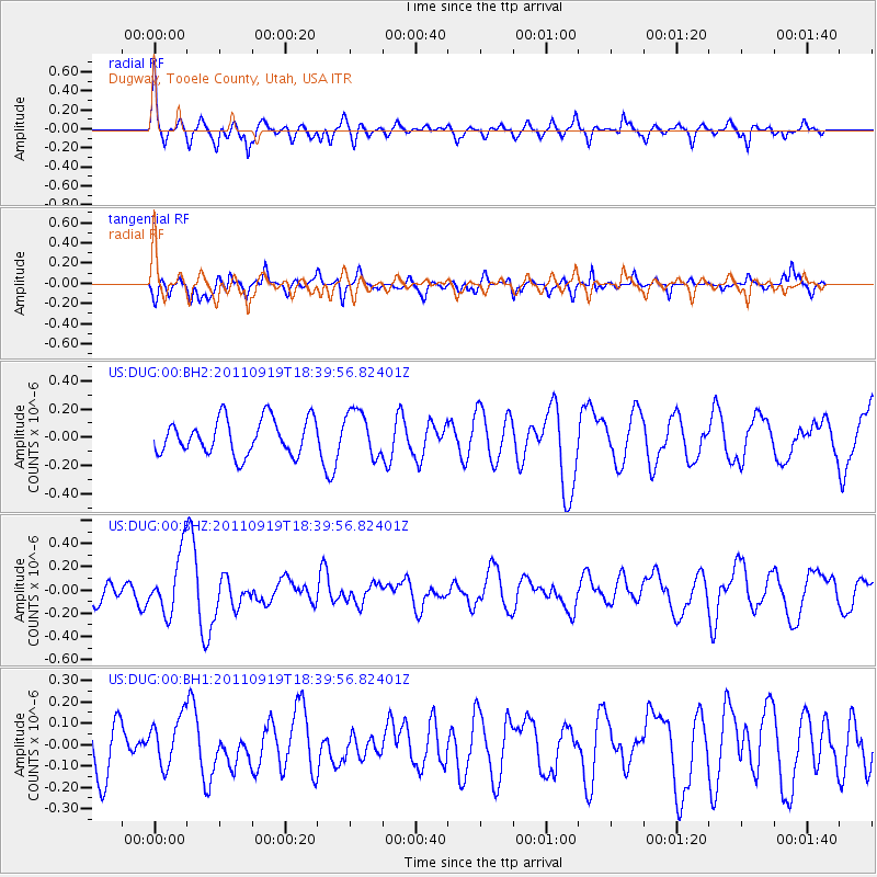
DUG Dugway, Tooele County, Utah, USA - Earthquake Result Viewer
*The percent match for this event was below the threshold and hence no stack was calculated.
| Earthquake location: |
Guatemala |
| Earthquake latitude/longitude: |
14.2/-90.2 |
| Earthquake time(UTC): |
2011/09/19 (262) 18:33:55 GMT |
| Earthquake Depth: |
9.0 km |
| Earthquake Magnitude: |
5.6 MW, 5.3 MS, 5.1 MB, 5.6 MW |
| Earthquake Catalog/Contributor: |
WHDF/NEIC |
|
| Network: |
US United States National Seismic Network |
| Station: |
DUG Dugway, Tooele County, Utah, USA |
| Lat/Lon: |
40.19 N/112.81 W |
| Elevation: |
1477 m |
|
| Distance: |
32.6 deg |
| Az: |
326.91 deg |
| Baz: |
136.268 deg |
| Ray Param: |
$rayparam |
*The percent match for this event was below the threshold and hence was not used in the summary stack. |
|
| Radial Match: |
65.657715 % |
| Radial Bump: |
328 |
| Transverse Match: |
48.88492 % |
| Transverse Bump: |
340 |
| SOD ConfigId: |
558545 |
| Insert Time: |
2013-09-19 03:28:56.312 +0000 |
| GWidth: |
2.5 |
| Max Bumps: |
400 |
| Tol: |
0.001 |
|
Signal To Noise
| Channel | StoN | STA | LTA |
| US:DUG:00:BHZ:20110919T18:39:56.82401Z | 2.8497667 | 2.5622688E-7 | 8.991153E-8 |
| US:DUG:00:BH1:20110919T18:39:56.82401Z | 1.1656507 | 1.1274282E-7 | 9.6720925E-8 |
| US:DUG:00:BH2:20110919T18:39:56.82401Z | 1.3100392 | 1.6245485E-7 | 1.2400763E-7 |
| Arrivals |
| Ps | |
| PpPs | |
| PsPs/PpSs | |


