You are here: Home > Network List > US - United States National Seismic Network Stations List
> Station AMTX Amarillo, Texas, USA > Earthquake Result Viewer
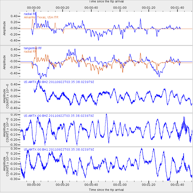
AMTX Amarillo, Texas, USA - Earthquake Result Viewer
*The percent match for this event was below the threshold and hence no stack was calculated.
| Earthquake location: |
Turkey |
| Earthquake latitude/longitude: |
39.8/38.8 |
| Earthquake time(UTC): |
2011/09/22 (265) 03:22:36 GMT |
| Earthquake Depth: |
5.0 km |
| Earthquake Magnitude: |
5.6 MW, 5.5 MW, 5.6 MB |
| Earthquake Catalog/Contributor: |
NEIC PDE/NEIC PDE-M |
|
| Network: |
US United States National Seismic Network |
| Station: |
AMTX Amarillo, Texas, USA |
| Lat/Lon: |
34.53 N/101.41 W |
| Elevation: |
1010 m |
|
| Distance: |
97.4 deg |
| Az: |
327.832 deg |
| Baz: |
29.795 deg |
| Ray Param: |
$rayparam |
*The percent match for this event was below the threshold and hence was not used in the summary stack. |
|
| Radial Match: |
57.04381 % |
| Radial Bump: |
400 |
| Transverse Match: |
33.26408 % |
| Transverse Bump: |
400 |
| SOD ConfigId: |
558545 |
| Insert Time: |
2013-09-19 03:33:24.645 +0000 |
| GWidth: |
2.5 |
| Max Bumps: |
400 |
| Tol: |
0.001 |
|
Signal To Noise
| Channel | StoN | STA | LTA |
| US:AMTX:00:BHZ:20110922T03:35:38.023979Z | 1.5568907 | 1.9116428E-7 | 1.2278593E-7 |
| US:AMTX:00:BH1:20110922T03:35:38.023979Z | 1.2580869 | 2.0753745E-7 | 1.6496273E-7 |
| US:AMTX:00:BH2:20110922T03:35:38.023979Z | 1.1569817 | 2.0774117E-7 | 1.795544E-7 |
| Arrivals |
| Ps | |
| PpPs | |
| PsPs/PpSs | |


