You are here: Home > Network List > US - United States National Seismic Network Stations List
> Station MNTX Cornudas Mountains, Texas, USA > Earthquake Result Viewer
MNTX Cornudas Mountains, Texas, USA - Earthquake Result Viewer

| Earthquake location: |
Tonga Islands |
| Earthquake latitude/longitude: |
-15.4/-175.3 |
| Earthquake time(UTC): |
2011/09/22 (265) 23:07:03 GMT |
| Earthquake Depth: |
10 km |
| Earthquake Magnitude: |
6.4 MW, 5.9 MB, 6.3 MS, 6.3 MW |
| Earthquake Catalog/Contributor: |
NEIC PDE/NEIC PDE-M |
|
| Network: |
US United States National Seismic Network |
| Station: |
MNTX Cornudas Mountains, Texas, USA |
| Lat/Lon: |
31.70 N/105.38 W |
| Elevation: |
404 m |
|
| Distance: |
81.7 deg |
| Az: |
54.002 deg |
| Baz: |
246.252 deg |
| Ray Param: |
0.047379598 |
| Estimated Moho Depth: |
67.0 km |
| Estimated Crust Vp/Vs: |
1.94 |
| Assumed Crust Vp: |
6.361 km/s |
| Estimated Crust Vs: |
3.279 km/s |
| Estimated Crust Poisson's Ratio: |
0.32 |
|
| Radial Match: |
95.10101 % |
| Radial Bump: |
353 |
| Transverse Match: |
82.27151 % |
| Transverse Bump: |
400 |
| SOD ConfigId: |
558545 |
| Insert Time: |
2013-09-19 03:36:59.647 +0000 |
| GWidth: |
2.5 |
| Max Bumps: |
400 |
| Tol: |
0.001 |
|
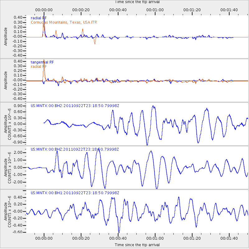
Signal To Noise
| Channel | StoN | STA | LTA |
| US:MNTX:00:BHZ:20110922T23:18:50.79998Z | 3.296981 | 3.4894958E-7 | 1.0583912E-7 |
| US:MNTX:00:BH1:20110922T23:18:50.79998Z | 1.5231359 | 9.005983E-8 | 5.9127903E-8 |
| US:MNTX:00:BH2:20110922T23:18:50.79998Z | 1.6216501 | 1.41285E-7 | 8.712422E-8 |
| Arrivals |
| Ps | 10 SECOND |
| PpPs | 30 SECOND |
| PsPs/PpSs | 40 SECOND |


