You are here: Home > Network List > US - United States National Seismic Network Stations List
> Station MSO Missoula, Montana, USA > Earthquake Result Viewer
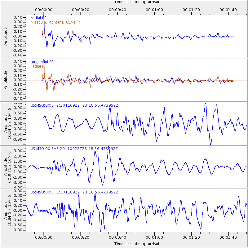
MSO Missoula, Montana, USA - Earthquake Result Viewer
*The percent match for this event was below the threshold and hence no stack was calculated.
| Earthquake location: |
Tonga Islands |
| Earthquake latitude/longitude: |
-15.4/-175.3 |
| Earthquake time(UTC): |
2011/09/22 (265) 23:07:03 GMT |
| Earthquake Depth: |
10 km |
| Earthquake Magnitude: |
6.4 MW, 5.9 MB, 6.3 MS, 6.3 MW |
| Earthquake Catalog/Contributor: |
NEIC PDE/NEIC PDE-M |
|
| Network: |
US United States National Seismic Network |
| Station: |
MSO Missoula, Montana, USA |
| Lat/Lon: |
46.83 N/113.94 W |
| Elevation: |
1264 m |
|
| Distance: |
82.8 deg |
| Az: |
37.404 deg |
| Baz: |
238.557 deg |
| Ray Param: |
$rayparam |
*The percent match for this event was below the threshold and hence was not used in the summary stack. |
|
| Radial Match: |
71.74915 % |
| Radial Bump: |
400 |
| Transverse Match: |
69.778 % |
| Transverse Bump: |
400 |
| SOD ConfigId: |
558545 |
| Insert Time: |
2013-09-19 03:37:03.309 +0000 |
| GWidth: |
2.5 |
| Max Bumps: |
400 |
| Tol: |
0.001 |
|
Signal To Noise
| Channel | StoN | STA | LTA |
| US:MSO:00:BHZ:20110922T23:18:56.473992Z | 1.7761347 | 3.8988335E-7 | 2.1951226E-7 |
| US:MSO:00:BH1:20110922T23:18:56.473992Z | 0.31746754 | 6.593161E-8 | 2.0767983E-7 |
| US:MSO:00:BH2:20110922T23:18:56.473992Z | 1.2764117 | 3.3190662E-7 | 2.6003102E-7 |
| Arrivals |
| Ps | |
| PpPs | |
| PsPs/PpSs | |


