You are here: Home > Network List > US - United States National Seismic Network Stations List
> Station AMTX Amarillo, Texas, USA > Earthquake Result Viewer
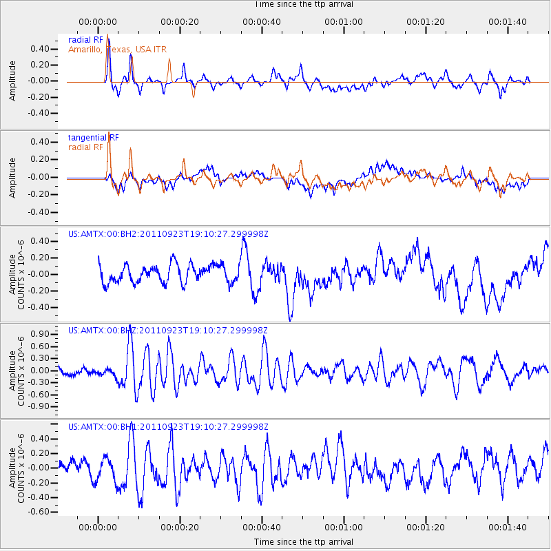
AMTX Amarillo, Texas, USA - Earthquake Result Viewer
*The percent match for this event was below the threshold and hence no stack was calculated.
| Earthquake location: |
Central East Pacific Rise |
| Earthquake latitude/longitude: |
-9.1/-109.4 |
| Earthquake time(UTC): |
2011/09/23 (266) 19:02:48 GMT |
| Earthquake Depth: |
10 km |
| Earthquake Magnitude: |
5.9 MW, 5.5 MS, 5.8 MW |
| Earthquake Catalog/Contributor: |
NEIC PDE/NEIC PDE-M |
|
| Network: |
US United States National Seismic Network |
| Station: |
AMTX Amarillo, Texas, USA |
| Lat/Lon: |
34.53 N/101.41 W |
| Elevation: |
1010 m |
|
| Distance: |
44.0 deg |
| Az: |
9.557 deg |
| Baz: |
191.457 deg |
| Ray Param: |
$rayparam |
*The percent match for this event was below the threshold and hence was not used in the summary stack. |
|
| Radial Match: |
79.69197 % |
| Radial Bump: |
400 |
| Transverse Match: |
44.89823 % |
| Transverse Bump: |
400 |
| SOD ConfigId: |
558545 |
| Insert Time: |
2013-09-19 03:39:14.952 +0000 |
| GWidth: |
2.5 |
| Max Bumps: |
400 |
| Tol: |
0.001 |
|
Signal To Noise
| Channel | StoN | STA | LTA |
| US:AMTX:00:BHZ:20110923T19:10:27.299998Z | 1.023097 | 9.503458E-8 | 9.288912E-8 |
| US:AMTX:00:BH1:20110923T19:10:27.299998Z | 1.6298773 | 1.6034753E-7 | 9.838012E-8 |
| US:AMTX:00:BH2:20110923T19:10:27.299998Z | 1.0714666 | 1.174246E-7 | 1.09592406E-7 |
| Arrivals |
| Ps | |
| PpPs | |
| PsPs/PpSs | |


