You are here: Home > Network List > US - United States National Seismic Network Stations List
> Station HAWA Hanford, Washington, USA > Earthquake Result Viewer
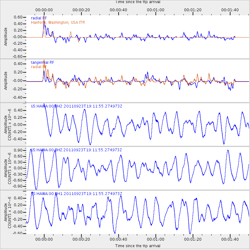
HAWA Hanford, Washington, USA - Earthquake Result Viewer
*The percent match for this event was below the threshold and hence no stack was calculated.
| Earthquake location: |
Central East Pacific Rise |
| Earthquake latitude/longitude: |
-9.1/-109.4 |
| Earthquake time(UTC): |
2011/09/23 (266) 19:02:48 GMT |
| Earthquake Depth: |
10 km |
| Earthquake Magnitude: |
5.9 MW, 5.5 MS, 5.8 MW |
| Earthquake Catalog/Contributor: |
NEIC PDE/NEIC PDE-M |
|
| Network: |
US United States National Seismic Network |
| Station: |
HAWA Hanford, Washington, USA |
| Lat/Lon: |
46.39 N/119.53 W |
| Elevation: |
364 m |
|
| Distance: |
55.9 deg |
| Az: |
351.58 deg |
| Baz: |
167.939 deg |
| Ray Param: |
$rayparam |
*The percent match for this event was below the threshold and hence was not used in the summary stack. |
|
| Radial Match: |
69.220985 % |
| Radial Bump: |
400 |
| Transverse Match: |
55.75167 % |
| Transverse Bump: |
400 |
| SOD ConfigId: |
558545 |
| Insert Time: |
2013-09-19 03:39:48.948 +0000 |
| GWidth: |
2.5 |
| Max Bumps: |
400 |
| Tol: |
0.001 |
|
Signal To Noise
| Channel | StoN | STA | LTA |
| US:HAWA:00:BHZ:20110923T19:11:55.274973Z | 1.8867313 | 5.462592E-7 | 2.8952678E-7 |
| US:HAWA:00:BH1:20110923T19:11:55.274973Z | 1.498079 | 2.626723E-7 | 1.7533942E-7 |
| US:HAWA:00:BH2:20110923T19:11:55.274973Z | 0.6064331 | 1.7176707E-7 | 2.832416E-7 |
| Arrivals |
| Ps | |
| PpPs | |
| PsPs/PpSs | |


