You are here: Home > Network List > US - United States National Seismic Network Stations List
> Station WMOK Wichita Mountains, Oklahoma, USA > Earthquake Result Viewer
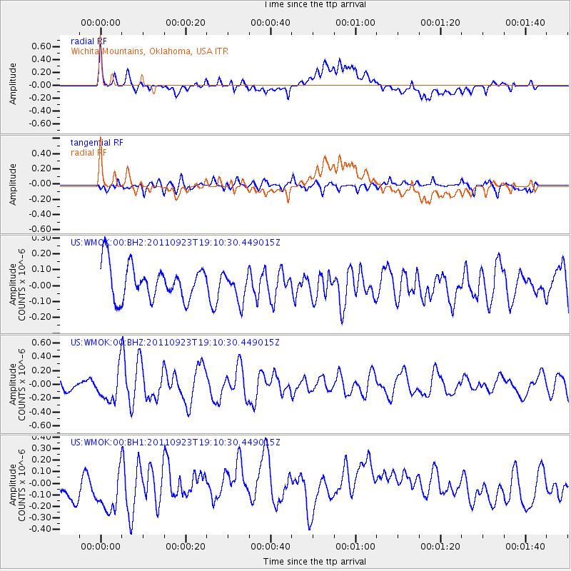
WMOK Wichita Mountains, Oklahoma, USA - Earthquake Result Viewer
*The percent match for this event was below the threshold and hence no stack was calculated.
| Earthquake location: |
Central East Pacific Rise |
| Earthquake latitude/longitude: |
-9.1/-109.4 |
| Earthquake time(UTC): |
2011/09/23 (266) 19:02:48 GMT |
| Earthquake Depth: |
10 km |
| Earthquake Magnitude: |
5.9 MW, 5.5 MS, 5.8 MW |
| Earthquake Catalog/Contributor: |
NEIC PDE/NEIC PDE-M |
|
| Network: |
US United States National Seismic Network |
| Station: |
WMOK Wichita Mountains, Oklahoma, USA |
| Lat/Lon: |
34.74 N/98.78 W |
| Elevation: |
486 m |
|
| Distance: |
44.7 deg |
| Az: |
12.506 deg |
| Baz: |
195.053 deg |
| Ray Param: |
$rayparam |
*The percent match for this event was below the threshold and hence was not used in the summary stack. |
|
| Radial Match: |
60.573994 % |
| Radial Bump: |
400 |
| Transverse Match: |
71.04572 % |
| Transverse Bump: |
400 |
| SOD ConfigId: |
558545 |
| Insert Time: |
2013-09-19 03:40:51.055 +0000 |
| GWidth: |
2.5 |
| Max Bumps: |
400 |
| Tol: |
0.001 |
|
Signal To Noise
| Channel | StoN | STA | LTA |
| US:WMOK:00:BHZ:20110923T19:10:30.449015Z | 1.9556994 | 2.4052946E-7 | 1.2298898E-7 |
| US:WMOK:00:BH1:20110923T19:10:30.449015Z | 1.4245614 | 2.580303E-7 | 1.8112964E-7 |
| US:WMOK:00:BH2:20110923T19:10:30.449015Z | 0.86151385 | 9.242255E-8 | 1.0727924E-7 |
| Arrivals |
| Ps | |
| PpPs | |
| PsPs/PpSs | |


