You are here: Home > Network List > CN - Canadian National Seismograph Network Stations List
> Station INK INUVIK, NT, CANADA.ANADA > Earthquake Result Viewer
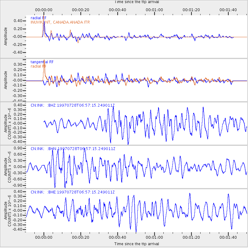
INK INUVIK, NT, CANADA.ANADA - Earthquake Result Viewer
*The percent match for this event was below the threshold and hence no stack was calculated.
| Earthquake location: |
Volcano Islands, Japan Region |
| Earthquake latitude/longitude: |
22.4/142.7 |
| Earthquake time(UTC): |
1997/07/28 (209) 06:46:55 GMT |
| Earthquake Depth: |
33 km |
| Earthquake Magnitude: |
5.7 MB, 5.8 MS, 5.9 UNKNOWN, 5.9 MW |
| Earthquake Catalog/Contributor: |
WHDF/NEIC |
|
| Network: |
CN Canadian National Seismograph Network |
| Station: |
INK INUVIK, NT, CANADA.ANADA |
| Lat/Lon: |
68.31 N/133.52 W |
| Elevation: |
40 m |
|
| Distance: |
67.1 deg |
| Az: |
23.647 deg |
| Baz: |
272.924 deg |
| Ray Param: |
$rayparam |
*The percent match for this event was below the threshold and hence was not used in the summary stack. |
|
| Radial Match: |
75.20521 % |
| Radial Bump: |
400 |
| Transverse Match: |
63.564163 % |
| Transverse Bump: |
400 |
| SOD ConfigId: |
4480 |
| Insert Time: |
2010-02-27 06:26:54.024 +0000 |
| GWidth: |
2.5 |
| Max Bumps: |
400 |
| Tol: |
0.001 |
|
Signal To Noise
| Channel | StoN | STA | LTA |
| CN:INK: :BHN:19970728T06:57:15.249011Z | 2.8973267 | 2.880114E-7 | 9.940591E-8 |
| CN:INK: :BHE:19970728T06:57:15.249011Z | 0.7398013 | 5.2612872E-8 | 7.1117576E-8 |
| CN:INK: :BHZ:19970728T06:57:15.249011Z | 1.9159005 | 1.2625328E-7 | 6.589762E-8 |
| Arrivals |
| Ps | |
| PpPs | |
| PsPs/PpSs | |


