You are here: Home > Network List > US - United States National Seismic Network Stations List
> Station CBKS Cedar Bluff, Kansas, USA > Earthquake Result Viewer
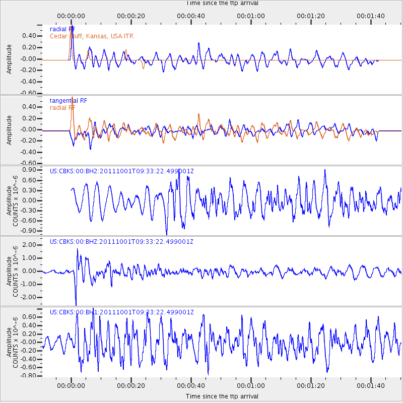
CBKS Cedar Bluff, Kansas, USA - Earthquake Result Viewer
*The percent match for this event was below the threshold and hence no stack was calculated.
| Earthquake location: |
Near Islands, Aleutian Islands |
| Earthquake latitude/longitude: |
51.8/172.1 |
| Earthquake time(UTC): |
2011/10/01 (274) 09:23:49 GMT |
| Earthquake Depth: |
10 km |
| Earthquake Magnitude: |
5.8 MB |
| Earthquake Catalog/Contributor: |
NEIC PDE/NEIC PDE-M |
|
| Network: |
US United States National Seismic Network |
| Station: |
CBKS Cedar Bluff, Kansas, USA |
| Lat/Lon: |
38.81 N/99.74 W |
| Elevation: |
677 m |
|
| Distance: |
59.7 deg |
| Az: |
64.773 deg |
| Baz: |
313.991 deg |
| Ray Param: |
$rayparam |
*The percent match for this event was below the threshold and hence was not used in the summary stack. |
|
| Radial Match: |
57.49015 % |
| Radial Bump: |
400 |
| Transverse Match: |
60.32931 % |
| Transverse Bump: |
400 |
| SOD ConfigId: |
558545 |
| Insert Time: |
2013-09-19 03:45:21.097 +0000 |
| GWidth: |
2.5 |
| Max Bumps: |
400 |
| Tol: |
0.001 |
|
Signal To Noise
| Channel | StoN | STA | LTA |
| US:CBKS:00:BHZ:20111001T09:33:22.499001Z | 5.8455496 | 8.662188E-7 | 1.4818431E-7 |
| US:CBKS:00:BH1:20111001T09:33:22.499001Z | 2.1745133 | 3.5247368E-7 | 1.6209313E-7 |
| US:CBKS:00:BH2:20111001T09:33:22.499001Z | 1.4186236 | 4.0490076E-7 | 2.8541803E-7 |
| Arrivals |
| Ps | |
| PpPs | |
| PsPs/PpSs | |


