You are here: Home > Network List > CN - Canadian National Seismograph Network Stations List
> Station INK INUVIK, NT, CANADA.ANADA > Earthquake Result Viewer
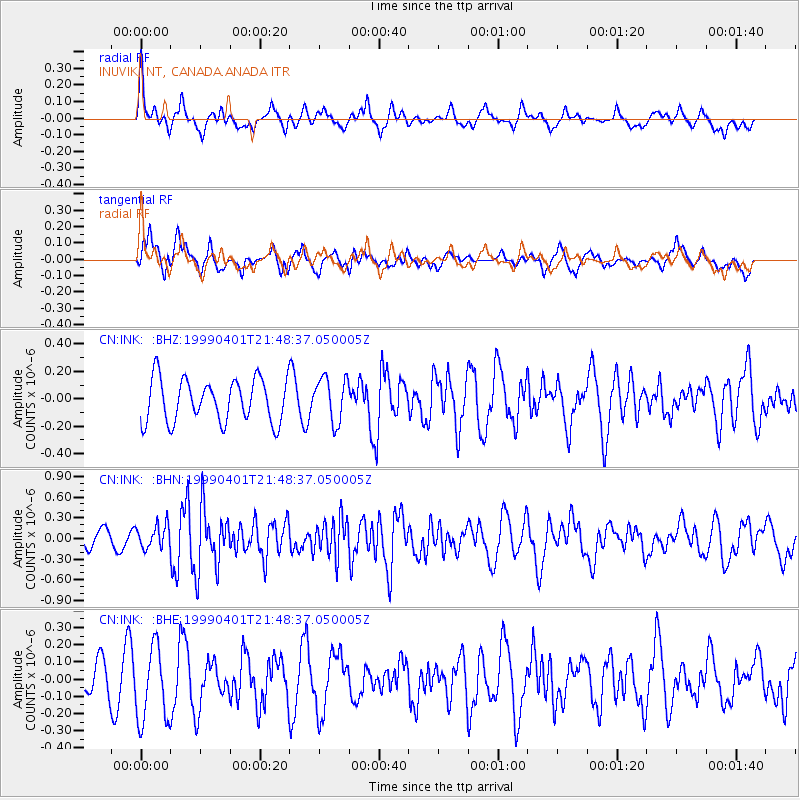
INK INUVIK, NT, CANADA.ANADA - Earthquake Result Viewer
*The percent match for this event was below the threshold and hence no stack was calculated.
| Earthquake location: |
New Britain Region, P.N.G. |
| Earthquake latitude/longitude: |
-4.4/152.7 |
| Earthquake time(UTC): |
1999/04/01 (091) 21:36:21 GMT |
| Earthquake Depth: |
33 km |
| Earthquake Magnitude: |
5.6 MB, 6.1 MS, 6.3 MW, 6.1 MW |
| Earthquake Catalog/Contributor: |
WHDF/NEIC |
|
| Network: |
CN Canadian National Seismograph Network |
| Station: |
INK INUVIK, NT, CANADA.ANADA |
| Lat/Lon: |
68.31 N/133.52 W |
| Elevation: |
40 m |
|
| Distance: |
88.1 deg |
| Az: |
20.927 deg |
| Baz: |
253.328 deg |
| Ray Param: |
$rayparam |
*The percent match for this event was below the threshold and hence was not used in the summary stack. |
|
| Radial Match: |
55.050034 % |
| Radial Bump: |
400 |
| Transverse Match: |
55.760136 % |
| Transverse Bump: |
400 |
| SOD ConfigId: |
4480 |
| Insert Time: |
2010-02-27 06:27:05.945 +0000 |
| GWidth: |
2.5 |
| Max Bumps: |
400 |
| Tol: |
0.001 |
|
Signal To Noise
| Channel | StoN | STA | LTA |
| CN:INK: :BHN:19990401T21:48:37.050005Z | 1.435241 | 1.699875E-7 | 1.184383E-7 |
| CN:INK: :BHE:19990401T21:48:37.050005Z | 2.5570886 | 2.2085845E-7 | 8.637106E-8 |
| CN:INK: :BHZ:19990401T21:48:37.050005Z | 1.0444618 | 1.6355439E-7 | 1.5659202E-7 |
| Arrivals |
| Ps | |
| PpPs | |
| PsPs/PpSs | |


