You are here: Home > Network List > IU - Global Seismograph Network (GSN - IRIS/USGS) Stations List
> Station HNR Honiara, Solomon Islands > Earthquake Result Viewer
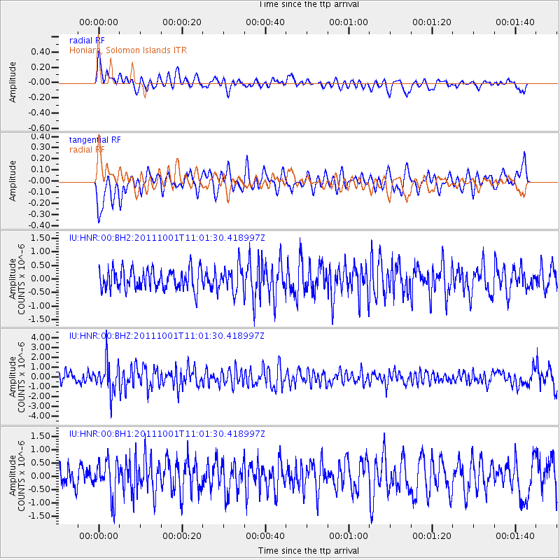
HNR Honiara, Solomon Islands - Earthquake Result Viewer
*The percent match for this event was below the threshold and hence no stack was calculated.
| Earthquake location: |
Off W. Coast Of S. Island, N.Z. |
| Earthquake latitude/longitude: |
-49.0/164.5 |
| Earthquake time(UTC): |
2011/10/01 (274) 10:54:29 GMT |
| Earthquake Depth: |
10 km |
| Earthquake Magnitude: |
5.5 MW, 5.6 MW, 5.6 MB |
| Earthquake Catalog/Contributor: |
NEIC PDE/NEIC PDE-M |
|
| Network: |
IU Global Seismograph Network (GSN - IRIS/USGS) |
| Station: |
HNR Honiara, Solomon Islands |
| Lat/Lon: |
9.44 S/159.95 E |
| Elevation: |
100 m |
|
| Distance: |
39.6 deg |
| Az: |
352.877 deg |
| Baz: |
175.251 deg |
| Ray Param: |
$rayparam |
*The percent match for this event was below the threshold and hence was not used in the summary stack. |
|
| Radial Match: |
67.25783 % |
| Radial Bump: |
400 |
| Transverse Match: |
68.69568 % |
| Transverse Bump: |
400 |
| SOD ConfigId: |
558545 |
| Insert Time: |
2013-09-19 03:47:37.548 +0000 |
| GWidth: |
2.5 |
| Max Bumps: |
400 |
| Tol: |
0.001 |
|
Signal To Noise
| Channel | StoN | STA | LTA |
| IU:HNR:00:BHZ:20111001T11:01:30.418997Z | 4.0336084 | 1.6033077E-6 | 3.974872E-7 |
| IU:HNR:00:BH1:20111001T11:01:30.418997Z | 1.7742049 | 6.7323396E-7 | 3.7945674E-7 |
| IU:HNR:00:BH2:20111001T11:01:30.418997Z | 1.2314944 | 4.53121E-7 | 3.67944E-7 |
| Arrivals |
| Ps | |
| PpPs | |
| PsPs/PpSs | |


