You are here: Home > Network List > IU - Global Seismograph Network (GSN - IRIS/USGS) Stations List
> Station PMG Port Moresby, New Guinea > Earthquake Result Viewer
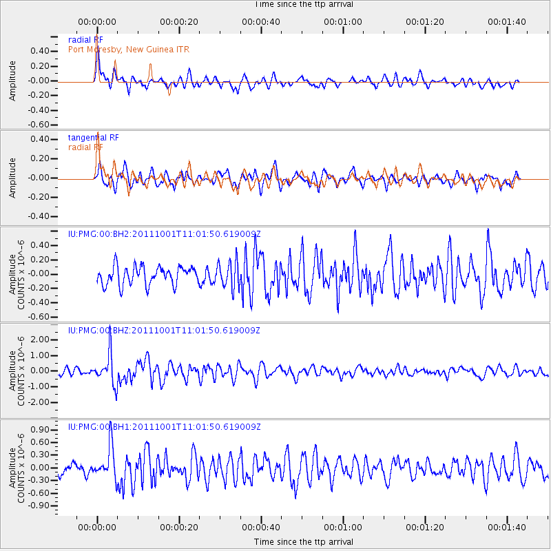
PMG Port Moresby, New Guinea - Earthquake Result Viewer
*The percent match for this event was below the threshold and hence no stack was calculated.
| Earthquake location: |
Off W. Coast Of S. Island, N.Z. |
| Earthquake latitude/longitude: |
-49.0/164.5 |
| Earthquake time(UTC): |
2011/10/01 (274) 10:54:29 GMT |
| Earthquake Depth: |
10 km |
| Earthquake Magnitude: |
5.5 MW, 5.6 MW, 5.6 MB |
| Earthquake Catalog/Contributor: |
NEIC PDE/NEIC PDE-M |
|
| Network: |
IU Global Seismograph Network (GSN - IRIS/USGS) |
| Station: |
PMG Port Moresby, New Guinea |
| Lat/Lon: |
9.40 S/147.16 E |
| Elevation: |
90 m |
|
| Distance: |
42.1 deg |
| Az: |
333.889 deg |
| Baz: |
162.91 deg |
| Ray Param: |
$rayparam |
*The percent match for this event was below the threshold and hence was not used in the summary stack. |
|
| Radial Match: |
73.49054 % |
| Radial Bump: |
400 |
| Transverse Match: |
65.36938 % |
| Transverse Bump: |
400 |
| SOD ConfigId: |
558545 |
| Insert Time: |
2013-09-19 03:47:49.771 +0000 |
| GWidth: |
2.5 |
| Max Bumps: |
400 |
| Tol: |
0.001 |
|
Signal To Noise
| Channel | StoN | STA | LTA |
| IU:PMG:00:BHZ:20111001T11:01:50.619009Z | 6.1414313 | 1.0353144E-6 | 1.6857867E-7 |
| IU:PMG:00:BH1:20111001T11:01:50.619009Z | 3.188435 | 4.030995E-7 | 1.2642549E-7 |
| IU:PMG:00:BH2:20111001T11:01:50.619009Z | 1.4517226 | 1.8250203E-7 | 1.2571412E-7 |
| Arrivals |
| Ps | |
| PpPs | |
| PsPs/PpSs | |


