You are here: Home > Network List > IU - Global Seismograph Network (GSN - IRIS/USGS) Stations List
> Station MAKZ Makanchi, Kazakhstan > Earthquake Result Viewer
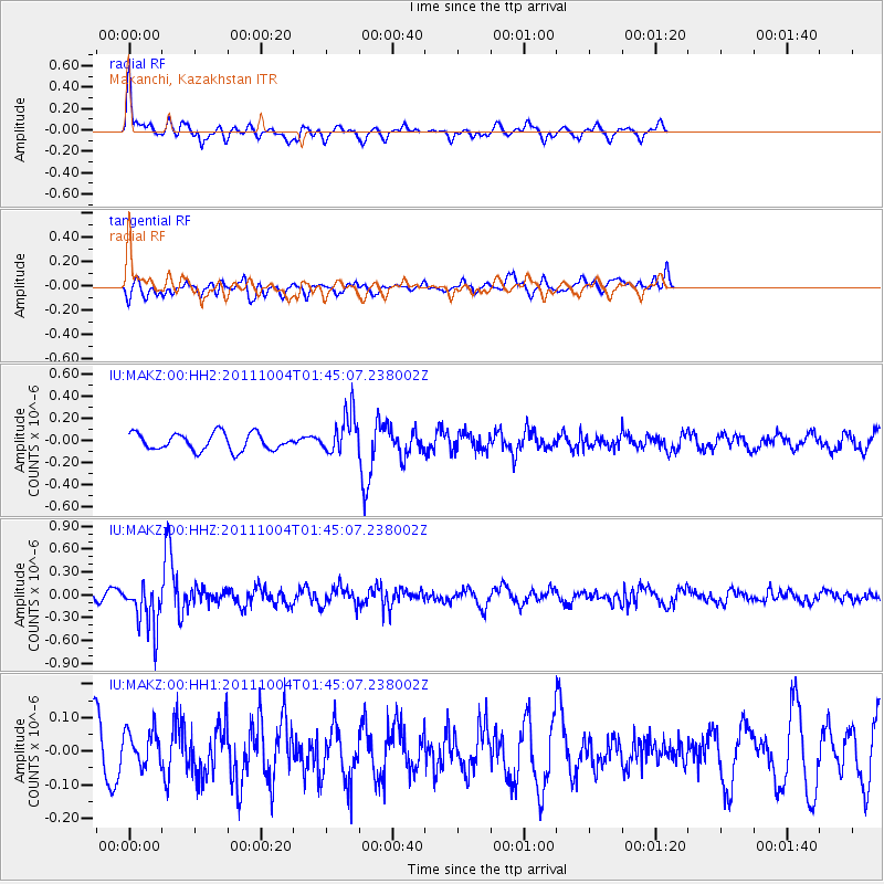
MAKZ Makanchi, Kazakhstan - Earthquake Result Viewer
*The percent match for this event was below the threshold and hence no stack was calculated.
| Earthquake location: |
Bonin Islands, Japan Region |
| Earthquake latitude/longitude: |
26.8/140.4 |
| Earthquake time(UTC): |
2011/10/04 (277) 01:37:29 GMT |
| Earthquake Depth: |
456 km |
| Earthquake Magnitude: |
5.6 MW, 5.7 MW |
| Earthquake Catalog/Contributor: |
NEIC PDE/NEIC PDE-M |
|
| Network: |
IU Global Seismograph Network (GSN - IRIS/USGS) |
| Station: |
MAKZ Makanchi, Kazakhstan |
| Lat/Lon: |
46.81 N/81.98 E |
| Elevation: |
600 m |
|
| Distance: |
49.7 deg |
| Az: |
309.861 deg |
| Baz: |
92.425 deg |
| Ray Param: |
$rayparam |
*The percent match for this event was below the threshold and hence was not used in the summary stack. |
|
| Radial Match: |
54.459705 % |
| Radial Bump: |
391 |
| Transverse Match: |
34.63476 % |
| Transverse Bump: |
400 |
| SOD ConfigId: |
558545 |
| Insert Time: |
2013-09-19 03:49:09.777 +0000 |
| GWidth: |
2.5 |
| Max Bumps: |
400 |
| Tol: |
0.001 |
|
Signal To Noise
| Channel | StoN | STA | LTA |
| IU:MAKZ:00:HHZ:20111004T01:45:07.238002Z | 4.2115035 | 3.0526158E-7 | 7.24828E-8 |
| IU:MAKZ:00:HH1:20111004T01:45:07.238002Z | 0.5727238 | 5.3277294E-8 | 9.302441E-8 |
| IU:MAKZ:00:HH2:20111004T01:45:07.238002Z | 2.4186094 | 1.879579E-7 | 7.77132E-8 |
| Arrivals |
| Ps | |
| PpPs | |
| PsPs/PpSs | |


