You are here: Home > Network List > IU - Global Seismograph Network (GSN - IRIS/USGS) Stations List
> Station PMG Port Moresby, New Guinea > Earthquake Result Viewer
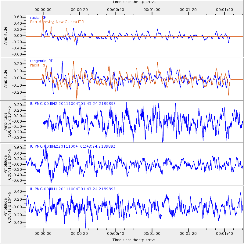
PMG Port Moresby, New Guinea - Earthquake Result Viewer
*The percent match for this event was below the threshold and hence no stack was calculated.
| Earthquake location: |
Bonin Islands, Japan Region |
| Earthquake latitude/longitude: |
26.8/140.4 |
| Earthquake time(UTC): |
2011/10/04 (277) 01:37:29 GMT |
| Earthquake Depth: |
456 km |
| Earthquake Magnitude: |
5.6 MW, 5.7 MW |
| Earthquake Catalog/Contributor: |
NEIC PDE/NEIC PDE-M |
|
| Network: |
IU Global Seismograph Network (GSN - IRIS/USGS) |
| Station: |
PMG Port Moresby, New Guinea |
| Lat/Lon: |
9.40 S/147.16 E |
| Elevation: |
90 m |
|
| Distance: |
36.5 deg |
| Az: |
168.801 deg |
| Baz: |
349.865 deg |
| Ray Param: |
$rayparam |
*The percent match for this event was below the threshold and hence was not used in the summary stack. |
|
| Radial Match: |
59.245068 % |
| Radial Bump: |
400 |
| Transverse Match: |
71.405 % |
| Transverse Bump: |
400 |
| SOD ConfigId: |
558545 |
| Insert Time: |
2013-09-19 03:49:15.504 +0000 |
| GWidth: |
2.5 |
| Max Bumps: |
400 |
| Tol: |
0.001 |
|
Signal To Noise
| Channel | StoN | STA | LTA |
| IU:PMG:00:BHZ:20111004T01:43:24.218989Z | 2.697971 | 3.7546877E-7 | 1.391671E-7 |
| IU:PMG:00:BH1:20111004T01:43:24.218989Z | 1.5443243 | 1.7116128E-7 | 1.10832474E-7 |
| IU:PMG:00:BH2:20111004T01:43:24.218989Z | 1.329027 | 1.3937941E-7 | 1.0487327E-7 |
| Arrivals |
| Ps | |
| PpPs | |
| PsPs/PpSs | |


