You are here: Home > Network List > US - United States National Seismic Network Stations List
> Station LAO LASA Array, Montana, USA > Earthquake Result Viewer
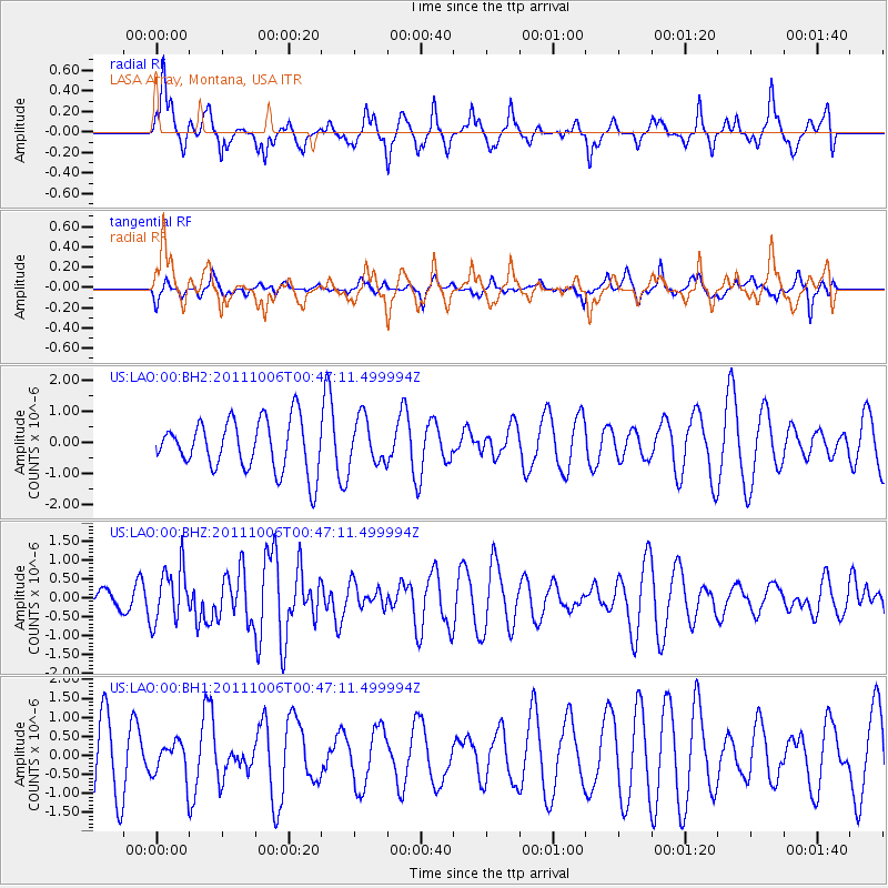
LAO LASA Array, Montana, USA - Earthquake Result Viewer
*The percent match for this event was below the threshold and hence no stack was calculated.
| Earthquake location: |
Reykjanes Ridge |
| Earthquake latitude/longitude: |
57.9/-32.5 |
| Earthquake time(UTC): |
2011/10/06 (279) 00:39:32 GMT |
| Earthquake Depth: |
10 km |
| Earthquake Magnitude: |
5.6 MW, 5.5 MW, 5.5 MS |
| Earthquake Catalog/Contributor: |
NEIC PDE/NEIC PDE-M |
|
| Network: |
US United States National Seismic Network |
| Station: |
LAO LASA Array, Montana, USA |
| Lat/Lon: |
46.69 N/106.22 W |
| Elevation: |
902 m |
|
| Distance: |
44.3 deg |
| Az: |
288.753 deg |
| Baz: |
47.28 deg |
| Ray Param: |
$rayparam |
*The percent match for this event was below the threshold and hence was not used in the summary stack. |
|
| Radial Match: |
66.11043 % |
| Radial Bump: |
366 |
| Transverse Match: |
38.025642 % |
| Transverse Bump: |
289 |
| SOD ConfigId: |
558545 |
| Insert Time: |
2013-09-19 03:52:29.383 +0000 |
| GWidth: |
2.5 |
| Max Bumps: |
400 |
| Tol: |
0.001 |
|
Signal To Noise
| Channel | StoN | STA | LTA |
| US:LAO:00:BHZ:20111006T00:47:11.499994Z | 1.960583 | 7.3011324E-7 | 3.7239602E-7 |
| US:LAO:00:BH1:20111006T00:47:11.499994Z | 0.5324108 | 4.587873E-7 | 8.617167E-7 |
| US:LAO:00:BH2:20111006T00:47:11.499994Z | 0.9149802 | 7.353885E-7 | 8.0372064E-7 |
| Arrivals |
| Ps | |
| PpPs | |
| PsPs/PpSs | |


