You are here: Home > Network List > US - United States National Seismic Network Stations List
> Station WUAZ Wupatki, Arizona, USA > Earthquake Result Viewer
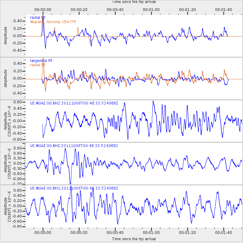
WUAZ Wupatki, Arizona, USA - Earthquake Result Viewer
*The percent match for this event was below the threshold and hence no stack was calculated.
| Earthquake location: |
Reykjanes Ridge |
| Earthquake latitude/longitude: |
57.9/-32.5 |
| Earthquake time(UTC): |
2011/10/06 (279) 00:39:32 GMT |
| Earthquake Depth: |
10 km |
| Earthquake Magnitude: |
5.6 MW, 5.5 MW, 5.5 MS |
| Earthquake Catalog/Contributor: |
NEIC PDE/NEIC PDE-M |
|
| Network: |
US United States National Seismic Network |
| Station: |
WUAZ Wupatki, Arizona, USA |
| Lat/Lon: |
35.52 N/111.37 W |
| Elevation: |
1592 m |
|
| Distance: |
55.0 deg |
| Az: |
282.394 deg |
| Baz: |
39.752 deg |
| Ray Param: |
$rayparam |
*The percent match for this event was below the threshold and hence was not used in the summary stack. |
|
| Radial Match: |
59.702507 % |
| Radial Bump: |
400 |
| Transverse Match: |
55.85237 % |
| Transverse Bump: |
400 |
| SOD ConfigId: |
558545 |
| Insert Time: |
2013-09-19 03:53:01.838 +0000 |
| GWidth: |
2.5 |
| Max Bumps: |
400 |
| Tol: |
0.001 |
|
Signal To Noise
| Channel | StoN | STA | LTA |
| US:WUAZ:00:BHZ:20111006T00:48:33.524988Z | 2.6059272 | 3.3742094E-7 | 1.294821E-7 |
| US:WUAZ:00:BH1:20111006T00:48:33.524988Z | 1.8428965 | 2.9197068E-7 | 1.5843031E-7 |
| US:WUAZ:00:BH2:20111006T00:48:33.524988Z | 1.1975803 | 2.1165553E-7 | 1.7673598E-7 |
| Arrivals |
| Ps | |
| PpPs | |
| PsPs/PpSs | |


