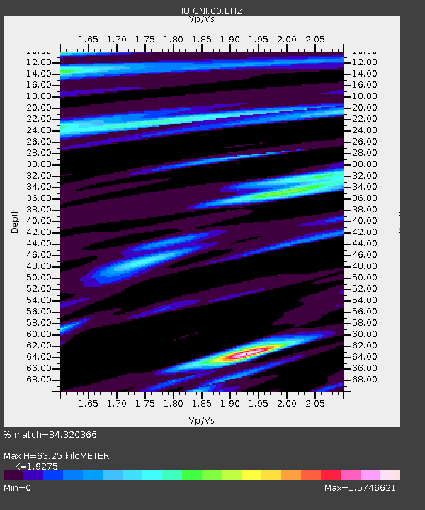
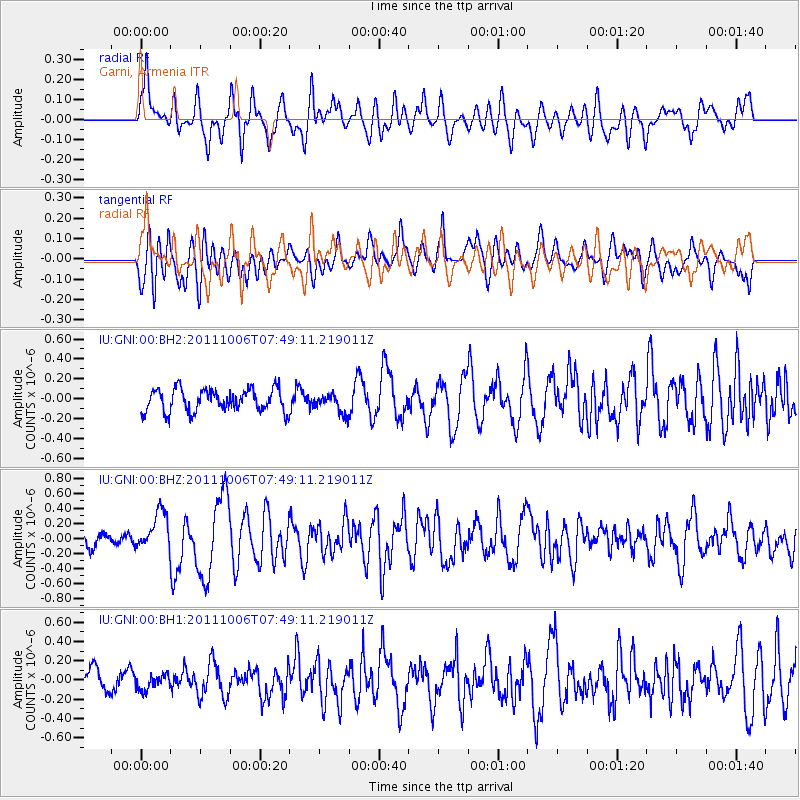
GNI Garni, Armenia - Earthquake Result Viewer

Earthquake location: W. Caroline Islands, Micronesia
Earthquake latitude/longitude: 9.7/138.2
Earthquake time(UTC): 2011/10/06 (279) 07:37:01 GMT
Earthquake Depth: 20 km
Earthquake Magnitude: 5.6 MB, 5.5 MS, 5.9 MW, 5.8 MW
Earthquake Catalog/Contributor: WHDF/NEIC
Network: IU Global Seismograph Network (GSN - IRIS/USGS)
Station: GNI Garni, Armenia
Lat/Lon: 40.15 N/44.74 E
Elevation: 1609 m
Distance: 86.5 deg
Az: 309.958 deg
Baz: 80.368 deg
Ray Param: 0.04400163
Estimated Moho Depth: 63.25 km
Estimated Crust Vp/Vs: 1.93
Assumed Crust Vp: 6.291 km/s
Estimated Crust Vs: 3.264 km/s
Estimated Crust Poisson's Ratio: 0.32
Radial Match: 84.320366 %
Radial Bump: 400
Transverse Match: 64.60036 %
Transverse Bump: 400
SOD ConfigId: 558545
Insert Time: 2013-09-19 03:53:55.589 +0000
GWidth: 2.5
Max Bumps: 400
Tol: 0.001

Signal To Noise

ChannelStoNSTALTA
IU:GNI:00:BHZ:20111006T07:49:11.219011Z3.3885882.5542897E-77.537918E-8
IU:GNI:00:BH1:20111006T07:49:11.219011Z0.59152147.594607E-81.2839108E-7
IU:GNI:00:BH2:20111006T07:49:11.219011Z0.861290459.750086E-81.1320323E-7
Arrivals
Ps9.5 SECOND
PpPs29 SECOND
PsPs/PpSs38 SECOND