You are here: Home > Network List > II - Global Seismograph Network (GSN - IRIS/IDA) Stations List
> Station WRAB Tennant Creek, NT, Australia > Earthquake Result Viewer
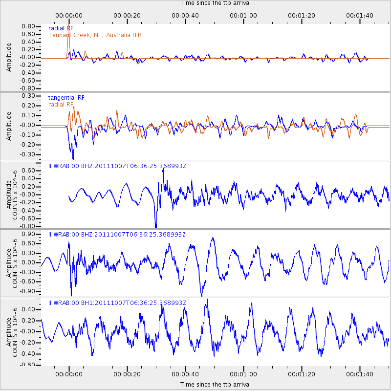
WRAB Tennant Creek, NT, Australia - Earthquake Result Viewer
*The percent match for this event was below the threshold and hence no stack was calculated.
| Earthquake location: |
Southeast Of Loyalty Islands |
| Earthquake latitude/longitude: |
-22.2/171.2 |
| Earthquake time(UTC): |
2011/10/07 (280) 06:30:19 GMT |
| Earthquake Depth: |
119 km |
| Earthquake Magnitude: |
5.6 MW |
| Earthquake Catalog/Contributor: |
NEIC PDE/NEIC PDE-M |
|
| Network: |
II Global Seismograph Network (GSN - IRIS/IDA) |
| Station: |
WRAB Tennant Creek, NT, Australia |
| Lat/Lon: |
19.93 S/134.36 E |
| Elevation: |
366 m |
|
| Distance: |
34.4 deg |
| Az: |
266.842 deg |
| Baz: |
100.432 deg |
| Ray Param: |
$rayparam |
*The percent match for this event was below the threshold and hence was not used in the summary stack. |
|
| Radial Match: |
44.25337 % |
| Radial Bump: |
400 |
| Transverse Match: |
75.18757 % |
| Transverse Bump: |
400 |
| SOD ConfigId: |
558545 |
| Insert Time: |
2013-09-19 03:58:50.057 +0000 |
| GWidth: |
2.5 |
| Max Bumps: |
400 |
| Tol: |
0.001 |
|
Signal To Noise
| Channel | StoN | STA | LTA |
| II:WRAB:00:BHZ:20111007T06:36:25.368993Z | 2.0950406 | 3.7243646E-7 | 1.7777052E-7 |
| II:WRAB:00:BH1:20111007T06:36:25.368993Z | 0.4954573 | 8.126001E-8 | 1.6401012E-7 |
| II:WRAB:00:BH2:20111007T06:36:25.368993Z | 2.69631 | 3.7046334E-7 | 1.3739643E-7 |
| Arrivals |
| Ps | |
| PpPs | |
| PsPs/PpSs | |


