You are here: Home > Network List > IU - Global Seismograph Network (GSN - IRIS/USGS) Stations List
> Station MAJO Matsushiro, Japan > Earthquake Result Viewer
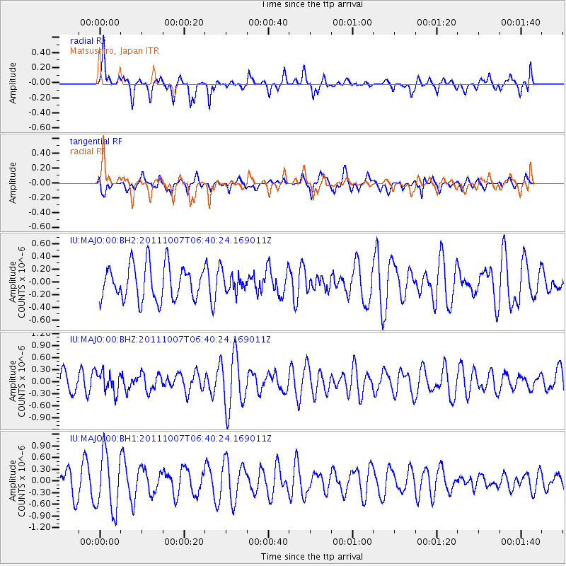
MAJO Matsushiro, Japan - Earthquake Result Viewer
*The percent match for this event was below the threshold and hence no stack was calculated.
| Earthquake location: |
Southeast Of Loyalty Islands |
| Earthquake latitude/longitude: |
-22.2/171.2 |
| Earthquake time(UTC): |
2011/10/07 (280) 06:30:19 GMT |
| Earthquake Depth: |
119 km |
| Earthquake Magnitude: |
5.6 MW |
| Earthquake Catalog/Contributor: |
NEIC PDE/NEIC PDE-M |
|
| Network: |
IU Global Seismograph Network (GSN - IRIS/USGS) |
| Station: |
MAJO Matsushiro, Japan |
| Lat/Lon: |
36.55 N/138.20 E |
| Elevation: |
405 m |
|
| Distance: |
66.2 deg |
| Az: |
331.351 deg |
| Baz: |
146.516 deg |
| Ray Param: |
$rayparam |
*The percent match for this event was below the threshold and hence was not used in the summary stack. |
|
| Radial Match: |
62.9844 % |
| Radial Bump: |
400 |
| Transverse Match: |
45.144863 % |
| Transverse Bump: |
400 |
| SOD ConfigId: |
558545 |
| Insert Time: |
2013-09-19 03:59:04.677 +0000 |
| GWidth: |
2.5 |
| Max Bumps: |
400 |
| Tol: |
0.001 |
|
Signal To Noise
| Channel | StoN | STA | LTA |
| IU:MAJO:00:BHZ:20111007T06:40:24.169011Z | 0.89562523 | 2.5618792E-7 | 2.8604364E-7 |
| IU:MAJO:00:BH1:20111007T06:40:24.169011Z | 1.9003627 | 7.318976E-7 | 3.8513573E-7 |
| IU:MAJO:00:BH2:20111007T06:40:24.169011Z | 0.48464265 | 1.3084086E-7 | 2.699739E-7 |
| Arrivals |
| Ps | |
| PpPs | |
| PsPs/PpSs | |


