You are here: Home > Network List > IU - Global Seismograph Network (GSN - IRIS/USGS) Stations List
> Station MAJO Matsushiro, Japan > Earthquake Result Viewer
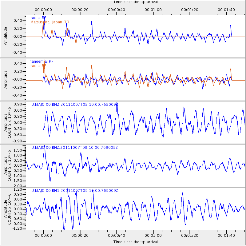
MAJO Matsushiro, Japan - Earthquake Result Viewer
*The percent match for this event was below the threshold and hence no stack was calculated.
| Earthquake location: |
South Of Kermadec Islands |
| Earthquake latitude/longitude: |
-32.5/-179.0 |
| Earthquake time(UTC): |
2011/10/07 (280) 08:58:28 GMT |
| Earthquake Depth: |
36 km |
| Earthquake Magnitude: |
5.9 MB, 5.8 MS, 6.1 MW, 6.1 MW |
| Earthquake Catalog/Contributor: |
WHDF/NEIC |
|
| Network: |
IU Global Seismograph Network (GSN - IRIS/USGS) |
| Station: |
MAJO Matsushiro, Japan |
| Lat/Lon: |
36.55 N/138.20 E |
| Elevation: |
405 m |
|
| Distance: |
79.5 deg |
| Az: |
326.218 deg |
| Baz: |
144.311 deg |
| Ray Param: |
$rayparam |
*The percent match for this event was below the threshold and hence was not used in the summary stack. |
|
| Radial Match: |
50.12041 % |
| Radial Bump: |
341 |
| Transverse Match: |
36.675407 % |
| Transverse Bump: |
386 |
| SOD ConfigId: |
558545 |
| Insert Time: |
2013-09-19 04:00:40.387 +0000 |
| GWidth: |
2.5 |
| Max Bumps: |
400 |
| Tol: |
0.001 |
|
Signal To Noise
| Channel | StoN | STA | LTA |
| IU:MAJO:00:BHZ:20111007T09:10:00.769009Z | 2.993025 | 9.317754E-7 | 3.113156E-7 |
| IU:MAJO:00:BH1:20111007T09:10:00.769009Z | 0.9601081 | 3.1462952E-7 | 3.277022E-7 |
| IU:MAJO:00:BH2:20111007T09:10:00.769009Z | 0.9887711 | 3.1007994E-7 | 3.1360136E-7 |
| Arrivals |
| Ps | |
| PpPs | |
| PsPs/PpSs | |


