You are here: Home > Network List > US - United States National Seismic Network Stations List
> Station TPNV Topopah Spring, Nevada, USA > Earthquake Result Viewer
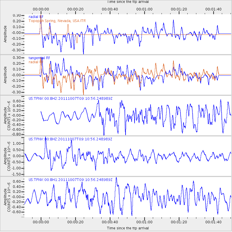
TPNV Topopah Spring, Nevada, USA - Earthquake Result Viewer
*The percent match for this event was below the threshold and hence no stack was calculated.
| Earthquake location: |
South Of Kermadec Islands |
| Earthquake latitude/longitude: |
-32.5/-179.0 |
| Earthquake time(UTC): |
2011/10/07 (280) 08:58:28 GMT |
| Earthquake Depth: |
36 km |
| Earthquake Magnitude: |
5.9 MB, 5.8 MS, 6.1 MW, 6.1 MW |
| Earthquake Catalog/Contributor: |
WHDF/NEIC |
|
| Network: |
US United States National Seismic Network |
| Station: |
TPNV Topopah Spring, Nevada, USA |
| Lat/Lon: |
36.95 N/116.25 W |
| Elevation: |
1600 m |
|
| Distance: |
90.6 deg |
| Az: |
45.437 deg |
| Baz: |
228.714 deg |
| Ray Param: |
$rayparam |
*The percent match for this event was below the threshold and hence was not used in the summary stack. |
|
| Radial Match: |
66.67387 % |
| Radial Bump: |
400 |
| Transverse Match: |
70.55253 % |
| Transverse Bump: |
400 |
| SOD ConfigId: |
558545 |
| Insert Time: |
2013-09-19 04:01:19.810 +0000 |
| GWidth: |
2.5 |
| Max Bumps: |
400 |
| Tol: |
0.001 |
|
Signal To Noise
| Channel | StoN | STA | LTA |
| US:TPNV:00:BHZ:20111007T09:10:56.248989Z | 2.5284083 | 5.3071176E-7 | 2.0989954E-7 |
| US:TPNV:00:BH1:20111007T09:10:56.248989Z | 0.8472356 | 2.0274305E-7 | 2.3929948E-7 |
| US:TPNV:00:BH2:20111007T09:10:56.248989Z | 2.0650456 | 2.9884856E-7 | 1.4471765E-7 |
| Arrivals |
| Ps | |
| PpPs | |
| PsPs/PpSs | |


